


Weather update: Thursday March 19th 5am

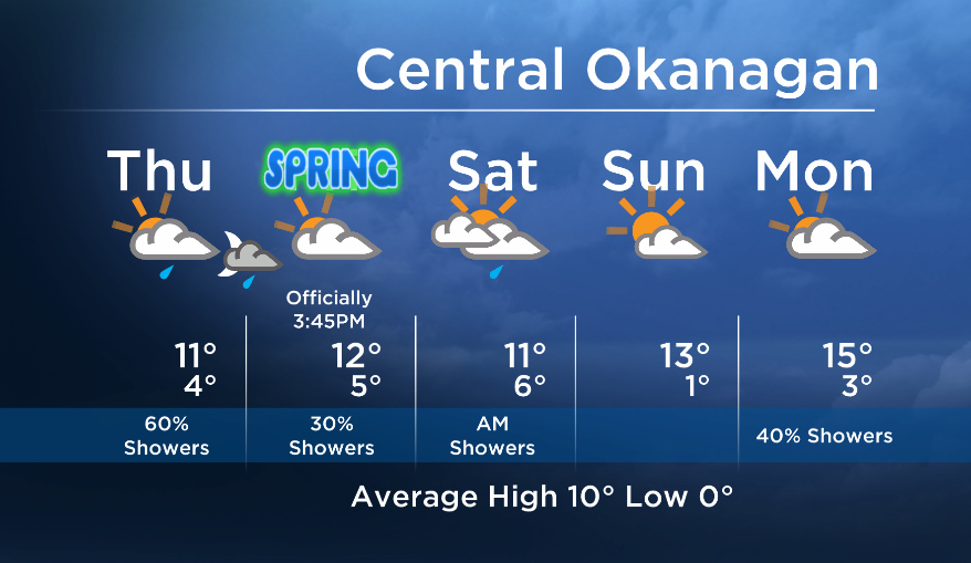
Waves of clouds and showers will move through over the next few days.
Expect showers to move into most areas today, with the exception of the extreme southern parts of the Okanagan and the Boundary region. These areas will just see a slight chance of showers.

Get breaking National news
Friday will be drier for the Okanagan Valley, however areas in the Columbia/Shuswap and areas near the mountains will continue to see a small risk of showers.
A moderate frontal system will move across the region with showers on Saturday morning, there is the potential for clearing by Saturday afternoon.
- Record slow hurricane season, but Maritimers warned to stay vigilant about extreme weather
- Tornado confirmed in Winnipeg neighbourhood, another west of the city
- ‘A lot of work ahead’: Storm-ravaged Saskatchewan cities continue cleanup
- ‘Warzone’: Storm rips through Winnipeg leaves thousands without power


Sunday will be the driest and brightest day of the weekend.
More details coming up at 5, 6:30 and 11pm!
Today’s daytime high range: 6 to 14C
~ Duane/Wesla


Comments
Want to discuss? Please read our Commenting Policy first.