
Weather update: Thursday January 15th 4:45pm

A frontal system will cross our region tonight bringing snow to many areas. The northern regions will see the most snow as there will multiple waves of snow over the next 24 hours.
However, snow totals will be different in the north and the south. Here’s why – with temperatures staying slightly above freezing for some areas in the South, it is possible for this regions to see mixed precipitation. This possibility makes forecasting snow amounts difficult as the variation of just a degree or two can make huge differences in snow accumulation. One of the hardest things to fine tune in weather forecasting is figuring out snow to liquid ratios in these types of scenarios.
With all that said, here are some estimates of snow amounts by Friday afternoon:
Shuswap: 4 to 10cm
North Okanagan: 3 to 8cm
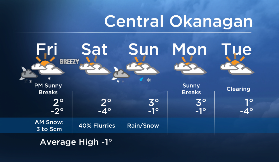
Central Okanagan: 3 to 6cm
South Okanagan: Trace to 4cm


Some of you will have to do some shoveling before work tomorrow, so you might want to set the alarm clocks a couple minutes early.
On a brighter note, in the wake of the cold front Friday afternoon, there is a good chance the sun will make a short appearance before another system pushes inland this weekend.
More details coming up at 5, 6:30 and 11pm!
Friday ‘s daytime high range: -2 to +4C
~ Duane/Wesla
- As Canada’s tax deadline nears, what happens if you don’t file your return?
- Posters promoting ‘Steal From Loblaws Day’ are circulating. How did we get here?
- Drumheller hoping to break record for ‘largest gathering of people dressed as dinosaurs’
- Planning a summer trip to Quebec’s Îles-de-la-Madeleine? You’ll have to pay up
Comments