
TORONTO – It may only be November, but across Ontario it’s looking — and feeling — a lot more like December.

Snow has blanketed the region over the past few days and more is on its way, which could make for a very messy Tuesday on the roads.
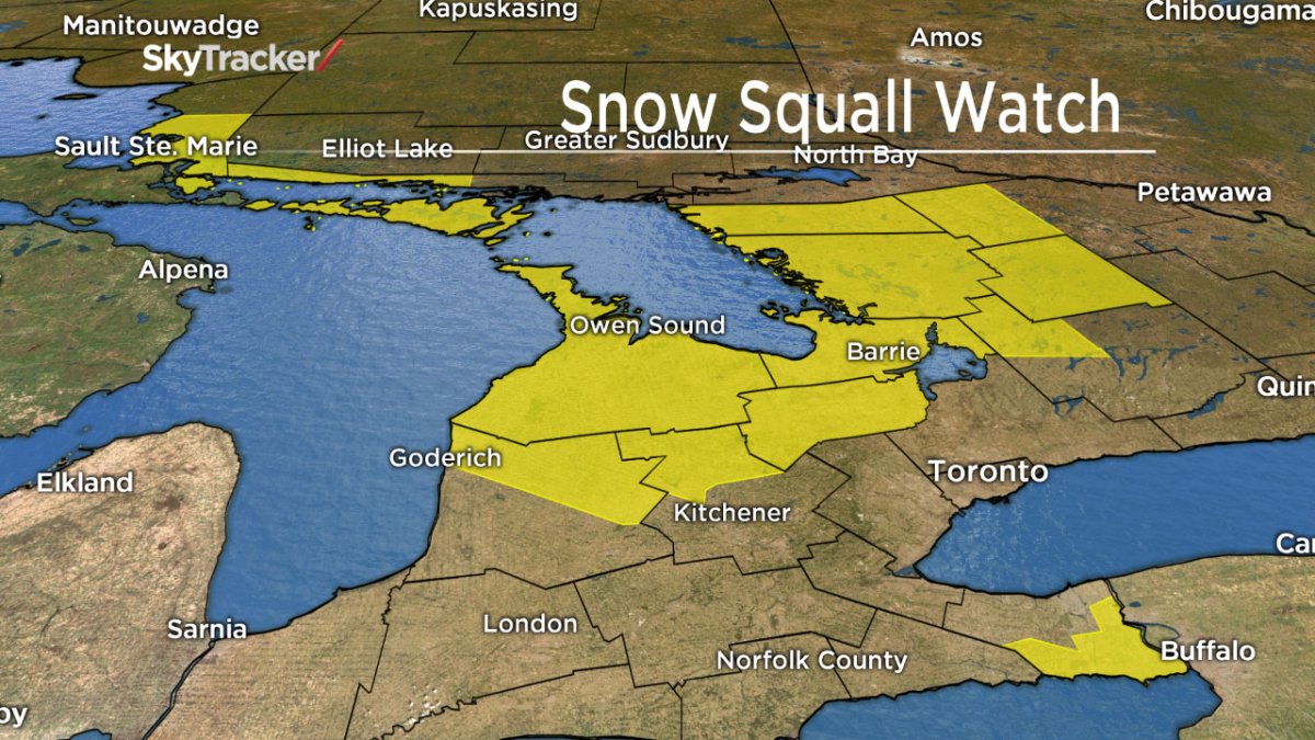
Environment Canada has issued snow squall warnings for parts of Ontario including, Barrie, Orillia, Midland, Haliburton, Listowel and Mount Forest.
READ MORE: Anthony Farnell’s winter forecast: Will it be as bad as last winter?
“It’s going to be very bad. A lot of snow, cold temperatures and very, very strong winds. Blizzard conditions, basically.”
Snow amounts of 15 to 25 cm are expected over a 12-hour period east of Lake Huron and Georgian Bay. But with winds gusting from 50 to 80 km/h, blizzard-like conditions could make driving hazardous.
On Friday, Sault Ste. Marie received 61 cm of snow. That’s almost double the snowfall for the entire month.
In one day. In November.
The culprit is lake effect snow.
Right now the lakes are still warmer than the Arctic air currently pushing down from the north. When the two meet, this creates lake effect snow.
“It takes a while for the lakes to freeze up. And this is why the snow squalls at the beginning of the season can be the worst,” Kimbell said.
Raw video: Car crashes across GTA as snow arrives
Ontario is no stranger to snow squalls.
“It’s not unusual to have snow squalls in November, but the severity with which we’re going to see the snow squall is going to be unusual for November because of the degree to which it’s going to be blowing around tomorrow.”
Kimbell said that he wouldn’t be surprised if road closures were a result.
“This is a time when snow squalls are at their worst.”
Though the cold Arctic air is what is causing the precipitation to fall as snow, there is some good news: By the end of the week, more seasonal temperatures will return to most of Ontario.
To get real-time weather for your area, download the Global News Skytracker weather app.
Comments