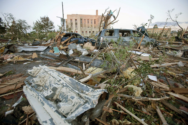
Days after a tornado devastated Goderich, Ontario, Environment Canada has issued a severe weather bulletin for southern Ontario.

It includes a tornado watch for:
Windsor – Essex – Chatham-Kent
Sarnia – Lambton
Elgin
London – Middlesex
Huron – Perth
Waterloo – Wellington
Dufferin – Innisfil
Grey – Bruce
Barrie – Orillia – Midland
Parry Sound – Muskoka
Burk’s Falls – Bayfield Inlet.
A risk of severe thunderstorms and isolated tornadoes is developing
this afternoon. A line of thunderstorms is expected to develop over Michigan this
afternoon then track rapidly eastward into southern Ontario.
Some of these storms are expected to be severe with large hail damaging
winds torrential downpours and frequent lightning. These storms
will also be capable of producing tornadoes.
The threat for severe weather is expected to reach areas near
Lake Huron near mid afternoon and the remainder of the regions in
the late afternoon or early evening.
While cause for concern, a tornado watch does not mean that twisters are imminent.

Get breaking National news
“A tornado watch means the conditions are ripe for the development of a tornado,” says Global News meteorologist Bill Coulter. “It’s a signal to watch the skies.”
A watch precedes a tornado warning, which essentially signals a violent storm or twister is occurring or imminent.
Before a watch is issued, a special weather statement may be delivered the day before or the morning of a forecasted event.
The statement is a non-urgent advisory that alerts people to pay attention to the forecast.
“You don’t want to cry wolf too often,” Dave Phillips, senior climatologist at Environment Canada explains.
“It comes down to urgency. Statements say “tune in’. The watch is to “˜look up’ and the warning is to “look out,’” he says.
“If there’s stormy weather moving into an area, that’s enough for them to say “this is real, it’s happening, get cover,’” Coulter explains.
“Any severe thunderstorm is capable of creating a tornado. But, even a weak thunderstorm can sometimes produce a tornado if the conditions are right,” he says.
“The warning has to be for something life threatening,” Phillips adds. “You don’t want to say “Tornado! Tornado! Tornado! Because people aren’t going to hear you…if we used a tornado warning every time we thought there was the possibility, we’re going to be wrong nine times out of ten.”
The anatomy of a twister is complex. Lift and shear are the main ingredients for a severe storm to turn into a twister. Lift refers to rising air while shear refers to winds changing direction with height.
Environment Canada reports Canada gets more tornadoes than any other country worldwide, second only to the United States.
Tornado season extends from April to September. June and July are particularly volatile months for twisters.
Environment Canada reports for every 100,000 thunderstorms about 10,000 of them are severe. Of those 10,000 storms, approximately 1,000 storms will develop into tornadoes.
In Ontario, about 12 tornadoes touchdown each year.


Comments