
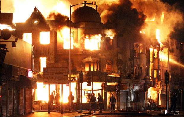
A wave of violence and looting raged across London and spread to three other major British cities on Tuesday, as authorities struggled to contain the country’s worst unrest since race riots set the capital ablaze in the 1980s.

In London, groups of young people rampaged for a third straight night, setting buildings, vehicles and garbage dumps alight, looting stores and pelting police officers with bottles and fireworks.

Get daily National news
Police called in hundreds of reinforcements – and made a rare decision to deploy armoured vehicles in some of the worst-hit districts – but still struggled to keep pace with the chaos unfolding at flashpoints across London, in the central city of Birmingham, the western city of Bristol and the northwestern city of Liverpool.
To see where the riots have spread to, view this interactive map created on Google Maps by London-based journalist James Cridland or follow @jamescridland on Twitter.
View London riots / UK riots: verified areas in a larger map
Comments
Want to discuss? Please read our Commenting Policy first.