
WATCH ABOVE: NASA explains El Niño

TORONTO – With more climatologists believing that the world is headed toward another potentially significant El Niño, here’s a look at what it is and why we should pay attention.
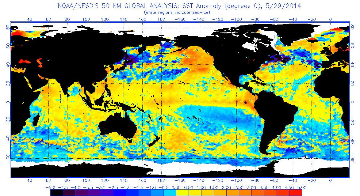
An El Niño (meaning “little boy” in Spanish) is characterized by unusually warm temperatures in the equatorial Pacific Ocean. Basically, there is an interaction between the ocean and atmosphere. Conversely, a La Niña (meaning “little girl” in Spanish) event is characterized by unusual cooling in the same region.
The National Oceanic and Atmospheric Administration(NOAA) — along with other meteorological organizations such as the Australian Bureau of Meteorology — keep a close eye on the ocean temperatures in the Pacific, an early indicator of the potential for an El Niño or La Niña event. These are phases known as the El Niño-Southern Oscillation (ENSO) cycles and typically last about nine to 12 months.
READ MORE: Tired of the cold? El Niño predicted to warm things up
There is also something called the Pacific Decadal Oscillation that plays a role. Similar to the ENSO, these cycles usually last decades, however.
“They are part of the natural variability of the Pacific,” Mike Halpert, acting director of NOAA’s Climate Prediction Center told Global News. “As far as we can tell, El Ninos and La Ninas go back thousands of years, so it’s not like there’s any link to any type of climate change signal,” Halpert said.

The ocean has low-level winds blowing from east to west that pushes warm water into the western part of the Pacific basin, into something called the warm pool. After some time, the reservoir of warm water builds up deep enough and the atmosphere, with westerly wind bursts, allow the warm water to cross the Pacific below the surface to surface.
There have been many El Niños over the past few years. The last significant El Niño was in 2009-2010, though it wasn’t as major as the one in 1997-1998. Before that one, the 1982-1983 El Niño was the largest of the 20th century.
Right now, NOAA is calling for an El Niño by the end of the summer with 67 per cent certainty. There is 80 per cent confidence that it will arrive by the end of the year.

Get daily National news
At the beginning of the year, the oceanic wave was very impressive, which got some climatologists believing that the ocean was setting itself up for an El Niño similar to the one in 1997-98. However, Halpert said, the wave hasn’t produced the same events from that one.
“We haven’t seen the follow-up,” he said. “So people are more in a ‘wait-and-see’ mode. The ocean is such that it could still evolve further, but we just haven’t seen that much evolution in the last month or so.”
The significance is that this pattern influences weather patterns worldwide, usually resulting in deviations from normal.
What can we expect in Canada?
Basically, it all depends on where you are. Here at home Environment Canada’s Senior Climatologist David Phillips thinks it more of a good news situation.
“All those ice fishers and snowmobilers had their moment last year,” he told Global News.
But he said Canadians need to be patient when it comes to seeing those effects. Those in the central or eastern part of the country will reap the benefits — if there are to be any — later.
Atlantic Canada will be the first to benefit from the El Niño if it is already underway.
Already forecasters are calling for a normal to below-normal season for Atlantic hurricanes. The storms will be less frequent and less intense. But that doesn’t mean there won’t be any at all, however, Phillips cautions.
For most of the country, an El Niño means that we’ll see milder winter, though, of course, there are no guarantees.
Since 1950, there have been about 17 El Niños, Phillips said. Of those, in Vancouver, 15 of those winters were warmer than normal and two were colder.
READ MORE: Hurricane season forecasts tied to El Nino
“What that says is that, hey, no guarantee: it could come out to be colder,” Phillips said. “But the dice are clearly loaded to give you a warmer than normal winter in the west.”
In Toronto, however, of those 17 El Niños, 10 were warmer and 7 were colder.
“But last year, we had one of the coldest winters on record. Long and cold.
“So I was thinking, even if this wasn’t going to be an El Niño year, nature is not going to have the energy to produce a similar kind of winter.”
That means an improvement in mood, a cost-savings, and an overall happier bunch of Canadians. Sure, there’s an opportunity for a polar vortex to visit, there this time there will be warmer air to send it packing back to its northern home.
Around the world
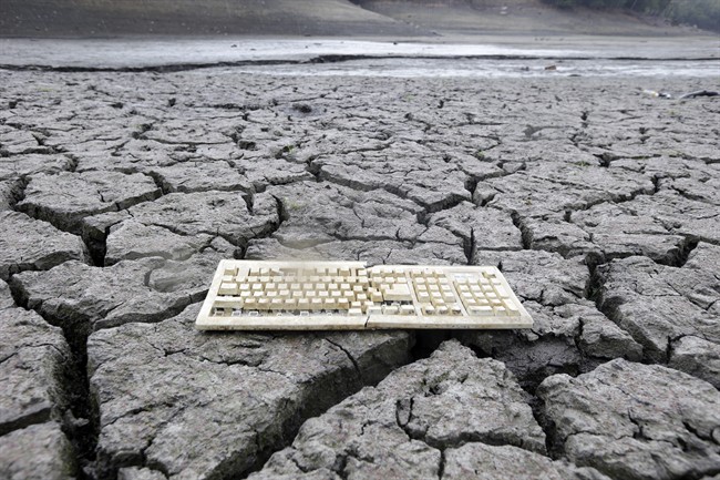
California, which has been enduring its worst drought in decades, may welcome the rain. However, it’s wise to be careful what you wish for.
“Back in ’97-’98, and then there was another strong event in the early ’80s and both of those were really too much rain, which resulted in a lot of flooding and landslides,” said Halpert.
But that’s only if it’s a strong event. A weaker event may not provide the west with the rain they need.
Some other effects
- In Indonesia and Northern Australia: Drier
- Over the Pacific Ocean or coastal areas of South America, like Ecuador and Peru: Wetter
- India: Suppressed monsoon season. But Halpert notes: “If this event doesn’t get going until later on in the summer or the fall, it might be fine, but then by next summer who knows if the event is still continuing.”
- Equatorial eastern part of Africa: Wetter from October to December
- Southern Africa: Drought
All these effects — even outside of Canada — can have their effects. There may be higher food prices, food shortages, and more of a need for disaster relief.
Climatologists still are unsure of the strength of the possible El Niño. NOAA’s next forecast is scheduled to be released on June 5.
“Until it’s here, we’ll never say it’s 100 per cent chance it’s happening, because we’re scientists and we know better than to do foolish like that,” he said.


Comments
Want to discuss? Please read our Commenting Policy first.