

Environment Canada has upgraded its snowfall weather alert for the Greater Toronto Area after the region got hit with a major snow storm on Thursday.

The weather agency initially classified it as a yellow alert, but upgraded it to an orange weather alert just before 8 a.m.
An orange snowfall alert is in place for Toronto and the surrounding areas including Durham, Peel and southern York regions as well as Guelph, Kitchener and down towards Niagara.
Environment Canada said snowfall amounts of 20-to-35 centimetres is expected for the area.
It warns of reduced visibility and heavy snow as well as local blowing snow. The snow is expected to continue through the morning and taper off late Thursday afternoon.
Temperatures also dropped significantly overnight reaching minus double digits. Toronto woke up to -22C with the wind chill on Thursday morning.
“A low pressure system will continue to bring significant snowfall to much of southern Ontario. Very cold wind chills by this morning will add to the adverse weather conditions,” the weather agency said.
It noted that non-essential travel should be avoided. The City of Toronto is declaring a “Major Snowstorm Condition and Significant Weather Event” as of 5 p.m. to free up resources for snow clearing, inspections and towing.
- Fourth complainant set to testify at sex assault trial of businessman Frank Stronach
- ‘Save OSAP’ campaign launched asking Ford government to reverse student loan changes
- Ontarians without a family doctor at higher risk of death, study finds
- Ontario government directs schools to let students watch Team Canada matches


Almost all schools in the Greater Toronto Area were closed to students and staff, with the exception of Durham region, due to the weather.
Environment Canada’s upgrade to an orange alert for GTA

Get daily National news
Environment Canada has recently started using a colour-coded system to make it easier to understand the severity of extreme weather and any risks that people might need to know about.
Orange alerts — a second-tiered warning — are issued when severe weather is likely to cause significant damage, disruption, or health impacts. Impacts can be major, widespread, and/or may last a few days.
Yellow alerts are typically the most common and red alerts are rare.
Monica Vaswani, a warning preparedness meteorologist with Environment Canada, tells Global News the decision to upgrade the warning to orange from yellow was the change in the weather system, which showed more snowfall and factored in its impact to a big city like Toronto or the wider GTA community.
“In this particular instance, one of the factors was the increase in snowfall,” Vaswani said. “Meteorologically speaking, there is a very heavy band of snow that has parked itself pretty much between the 401 and the 407 right across the GTA — and that’s bringing very heavy snowfall rates.”
Vaswani called it a “very difficult system to forecast” as it initially started off as showing just a couple of centimetres, which then grew to show a “grim story” of a big weather event.
“In terms of upgrading from yellow to orange, we need a little bit more confidence in order to do that,” Vaswani said. “Because a lot of the snow had fallen overnight, it’s hard to really have a grasp on those impacts until we start hearing things from the community.”
“Until we started seeing those decisions that are made by school boards, until we starting seeing cars on the road, and then in many cases, it was as simple as we had meteorologists driving in that snow and recognizing, this is really, really bad ... In this case, I think it’s sort of the nature of the weather, unfortunately, that gave us that upgrade this morning as opposed to earlier on in the event.”


Vaswani said the low pressure system is hovering stateside bringing the heaviest snow to the north side of the low into southern Ontario. She said its going to continue affecting the Greater Toronto Area towards the Quebec border throughout the afternoon. It’s not expected to move out of the province until about midnight, she noted.
In addition to the GTA, Environment Canada has also placed the Ottawa-area under an orange snowfall weather alert. The warning is similar as snowfall amounts of 20-to-35 centimetres is expected. The snow is forecast to taper off there by Thursday night.
Meanwhile, a large swath of southern Ontario is feeling the blast of snow from the weather system.
Yellow snowfall warnings stretch from the London area north to Barrie and Orillia and east through Peterborough and Kingston. These areas can see anywhere from 5 to 10 centimetres of snow, or 15 to 25 centimetres of snow.
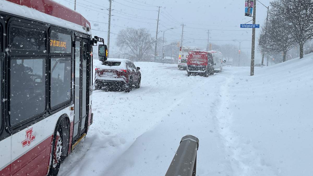
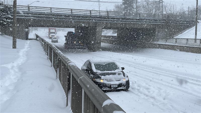
Roads across the GTA were paralyzed from the storm as major routes such as highways, expressways and interior roads were covered in a significant amount of snow and with black ice causing slippery conditions.
The storm has also caused significant disruption at Toronto Pearson International Airport, which has caused dozens of cancellations and delays.
Global News chief meteorologist Anthony Farnell said the system is the most significant winter storm to hit the region since January 2022.
Comments
Want to discuss? Please read our Commenting Policy first.