
TORONTO – Though here in the city, there’s been negligible snowfall, north of the GTA, it’s a different story.

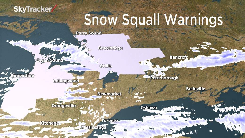
Areas in cottage country, like Bracebridge and Muskoka, have been experiencing snow squalls since Monday.
“In this particular case…the very cold, Arctic air coming down from the Prairies and Northern Ontario, passing over the open waters and relatively warmer waters of the Great Lakes is generating the activity, but of particular note I think with this event is just the longevity,” said Geoff Coulson of Environment Canada.
The colder temperatures and warmer waters of Georgian Bay and Lake Huron are combining with the wind coming out of the west, a perfect recipe for snow squalls.

Get breaking National news
“The other thing of note, which is fairly rare, is the penetration of these bands of snow all the way into eastern Ontario. We had impacts in and around the Ottawa area yesterday, there was a fatal car collision on the 416, likely linked to the poor driving conditions at the time,” Coulson said.
Coulson said that Environment Canada received an anecdotal report of some 60 cm of snow accumulation in Orrville, south of Parry Sound.
“We have squalls that begin their life south of Manitoulin Island and extend all the way to the St. Lawrence River, just about Brockville, Cornwall area…so that’s another testament to how locked-in the winds are in the low levels allowing these squalls to penetrate very, very far inland.”


Fortunately for those who have to shovel the snow, the snow isn’t laden with moisture, so what’s falling is light and fluffy.
The system that’s expected to move up from the American southwest on Friday, is unlikely to bring a lot more to the areas already affected by the squalls.
READ MORE: Chilly weather in Ontario, snow on its way
The track of the system isn’t very clear. Some weather models have the heaviest bands of snow affecting Ohio, Pennsylvania, and western New York state. However, there is the possibility that London, Windsor, and the Greater Toronto Area may be affected with 10 to 15 cm of snow on Saturday and Sunday. If it tracks farther south, the areas could just see 5 to 10 cm.
Comments
Want to discuss? Please read our Commenting Policy first.