Frigid temperatures have moved into southern Ontario — so how long will this period of cold weather last?

“We’ve been watching residents in western Canada shiver under the deep freeze for days and now that cold air has finally spread east into southern Ontario,” Global News meteorologist Anthony Farnell said Monday.
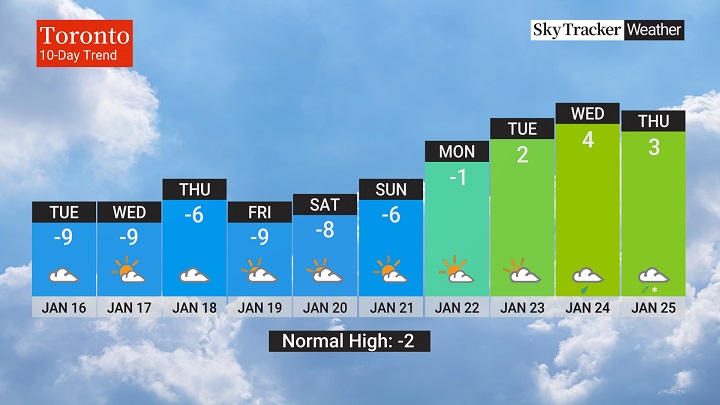
He said temperatures are going to remain five to 10 C below seasonal all week “with an almost constant wind from the southwest creating wind chills that will drop below -20 at times.”
The conditions also mean that some areas are seeing intense lake effect snow squalls.
Farnell said the mild weather in December means that there isn’t much ice coverage on the Great Lakes, so when the cold air moves across the water, it picks up moisture and lake-effect snow develops.
“These snow squalls are particularly intense this week because of that temperature differential between the lake water temperature and that of the air above,” Farnell said.

Get daily National news
“Winds are also aligned through the atmosphere which aids in lake effect snow squall formation.”
As of the noon hour Monday, snow squall warnings were in effect for Niagara Falls and the southern Niagara Region, the Norfolk County area, the Owen Sound / Blue Mountains area, part of Prince Edward County, as well as up in the Parry Sound, North Bay, and Manitoulin Island areas.
“These lakes being unfrozen also moderates the air temperature and that is the main reason we are not seeing the same level of cold as our Prairie province neighbours,” Farnell noted.
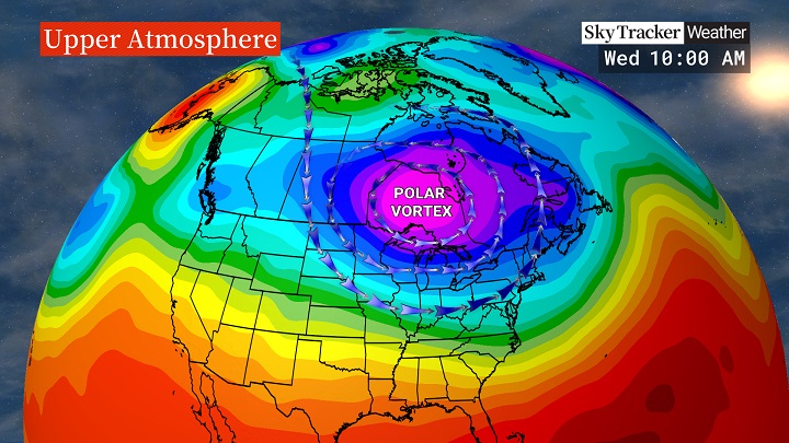
The part of the polar vortex that’s causing the frigid temperatures will slowly weaken and move into far nothern Canada by the weekend, Farnell said, “taking the deep freeze away with it.”
By next Monday, temperatures are expected to return to seasonal in southern Ontario and there may even be several days above freezing, he said.


Comments