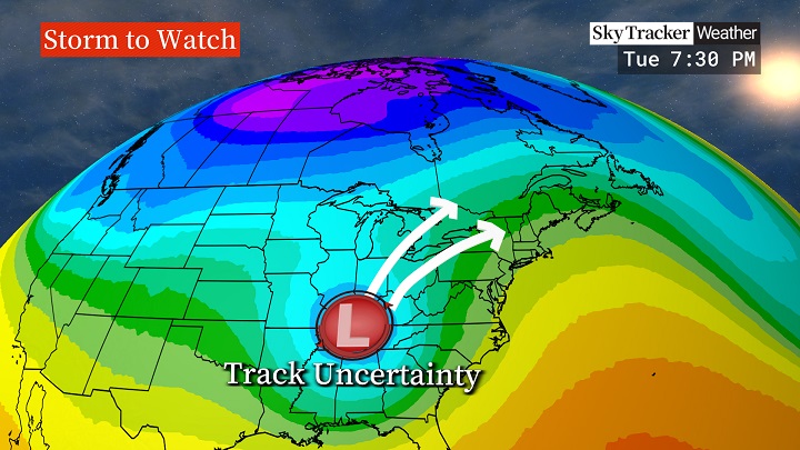
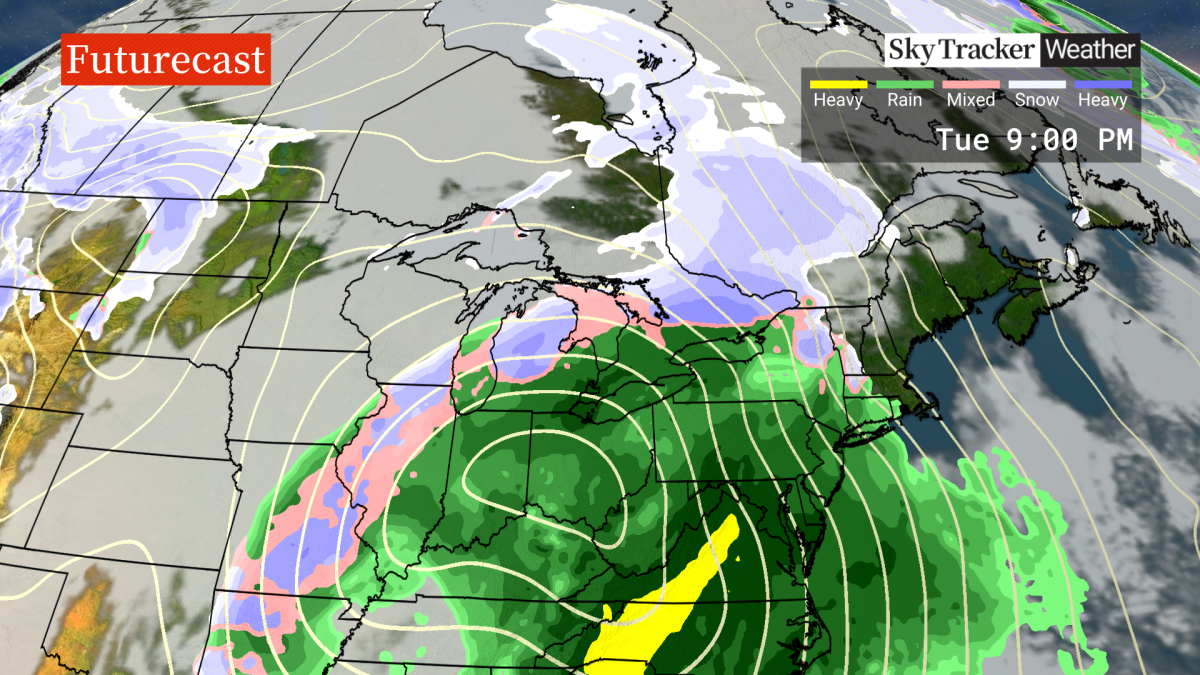
A “potent storm” likely bringing strong, possibly damaging winds is expected to hit southern Ontario next week, though significant uncertainty remains regarding its track and what precipitation type areas will see.

Meteorologists are tracking the system that’s set to develop over Texas before eventually moving into the Great Lakes.
“We do know there is a potent storm on the way in the Tuesday to Wednesday timeframe next week, but we are not as clear on what the exact impacts will be in terms of precipitation type and amounts,” Global News meteorologist Ross Hull said.
“Strong, possibly damaging winds will likely be a component of this Texas Low as it moves over the Great Lakes — especially for areas closer to the shores of Lakes Ontario and Erie.”
The type of precipitation areas will see will “highly depend” on the storm’s track as it emerges out of Texas, Hull said.
A track west through Ohio will bring wet snow changing into rain for a good part of southern Ontario, he added. A move to the east will mean colder air and likely higher snow totals for the region.

Get daily National news
“To complicate things even further, there’s also a scenario where precipitation starts as snow, turns to rain, then transitions back to snow. There’s also the possibility of mixed precipitation,” Hull said. “Some of the more dependable computer models have been leaning towards a warmer outcome, but that’s not yet a certainty.”
- Most flood preparations complete in First Nation as it braces for rising water
- Residents of Peace River warned of possible flooding, to be ready to evacuate
- Spring snowstorm drops 10 cm of snow on Cranbrook, knocks out power
- Montreal community ramps up flood defences as rising river levels spark concern
Hull said the system will “signal an important pattern change” in southern Ontario after a relatively storm-free winter so far.
“If this storm doesn’t provide the snow that has been elusive so far this winter, it does look like a pattern change is on the way over the next couple of weeks — cold and storms likely delivering more typical January weather,” he said.
Hull said meteorologists will have a better understanding over the weekend of what can be expected from next week’s storm.


Comments
Want to discuss? Please read our Commenting Policy first.