

A large, intense winter storm continues to rage across central Alberta.

The storm system, with heavy snow and high winds, moved into the area on Saturday, intensifying on Sunday.
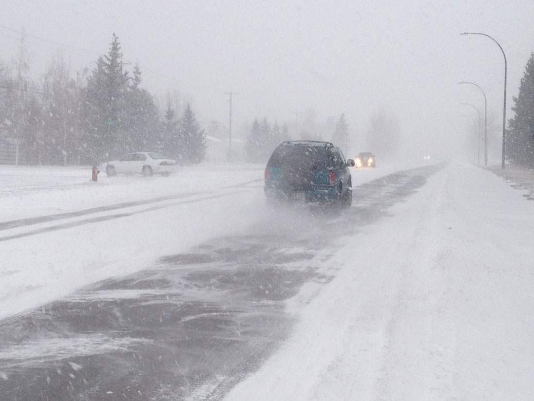
Up to 30 cm of snow has fallen on some parts of the province, particularly near the foothills. Grande Prairie has already seen more than 30 cm fall, and the snow isn’t stopping any time soon.
READ MORE: Intense winter storm hits Calgary
A time lapse of the weather system that is blowing across Alberta. Snowfall warnings, in white, and blizzard warnings, purple, have been issued across the province.
The low-pressure system formed south of the border in Idaho and Montana, bringing with it the moisture that is associated with this type of weather system. Along with it came high winds that quickly reduced visibility on roads.
In Calgary, several schools were closed. Even Mayor Naheed Nenshi warned motorists to keep off the roads.
It was good advice: the City of Calgary Transportation Department reported an 11-vehicle collision late Monday morning. It was just one of several accidents across the city.
What made the system even more intense was the strong ridge of high pressure up through the Yukon and Alaska.
There were two systems at play that made a perfect recipe for the wintry weather.

Get breaking National news
“That Arctic ridge of high pressure is starting to build southwards,” said Bill McMurtry, Warning Preparedness Meteorologist for Environment Canada. “As it builds southwards, it’s pushing this very cold Arctic air across the province, and that’s mixing with the somewhat slightly warmer air and moist air.”
As these meet, they clash, producing significant weather — like the snow — for most of the province.
Between 10 and 20 cm have fallen in most places and the snow is expected to continue into Tuesday.
“But really…we’re getting strong winds as well,” McMurtry said. “That’s why we have blizzard warnings out for a significant portion of southern and south central Alberta, especially in exposed areas where there aren’t as many trees, so you’re seeing extensive reduced visibility.”
“It’s a large-scale event and it’s a fairly long-lived event in that it’s going to last for about a day and a half before it starts to move off.”
The system will move out of the region Tuesday afternoon, bringing a good-news/bad-news situation.
The good news is that by Wednesday much of the province will enjoy sunny skies.
The bad news is that temperatures will continue to drop as the Arctic ridge settles over the area.
Southern parts of the province can expect daytime highs near -20 and overnight lows of near -25 C.
Central Alberta will be even colder.
But by the weekend, temperatures will return to the near average of -5 C.
As for this system, McMurtry said that, though not your everyday system, a storm like this one isn’t unusual for the province.
“It’s not that uncommon to see winter outbreaks like this once you get to the end of November into December. And December usually is quite an active month where we start to see some of these.
“This particular event is quite intense in that we’re dealing with a lot of snow, it’s covering a large portion of the province and some very strong winds. So this one has a particularly hard impact.”
To get real-time weather for your area, download the Skytracker weather app.
-
![]() Carney’s gas tax holiday to cost $2.4B, last until Labour Day
Carney’s gas tax holiday to cost $2.4B, last until Labour Day -
![]() Spirit Airlines goes out of business after 34 years, ending operations immediately
Spirit Airlines goes out of business after 34 years, ending operations immediately -
![]() Health Matters: Archbishop of Toronto calls for end to MAID expansion
Health Matters: Archbishop of Toronto calls for end to MAID expansion -
![]() Sandy Beach, Alta. residents remain on evacuation standby as wildfire burns down homes
Sandy Beach, Alta. residents remain on evacuation standby as wildfire burns down homes


Comments
Want to discuss? Please read our Commenting Policy first.