

_848x480_1502319171866.jpg?w=1040&quality=70&strip=all)
Several homes along the Burnt River in the City of Kawartha Lakes were evacuated Sunday due to rising water levels.

David Kish, Kawartha Lakes Fire Rescue district fire chief, says residents from three homes on Cedar Plank Road chose to evacuate and required assistance from firefighters, who used rafts to carry the residents. No one was injured.
“Our guys were getting fatigued walking in and out but we got everyone out as fast as we can,” said Kish.
Kish said there are currently no mandatory evacuation orders as officials continue to monitor water levels in the area about 40 kilometres north of Lindsay.
“Water levels have started to stabilize at this time,” Kish told Global Peterborough on Monday morning. “Hopefully we’ll start to see the water recede.”
“This is the worst we’ve seen since we’ve lived here,” said Tracy Puddister, a resident of Shuttleworth Road for 17 years. “Luckily, we sandbagged the doors yesterday. It got up onto the deck, but it looks like it receded a bit. We don’t have any water damage inside of the house.”
Kawartha Conservation reported Saturday that nearly 42 mm of rain had fallen over the previous 36 hours in its jurisdiction, prompting a flood watch for the watershed. The warning will remain in effect until Tuesday.
The conservation authority said flows in the northern tributaries are extremely high, leading to rising water levels in the Burnt River area along with Balsam, Cameron, Sturgeon and Pigeon lakes.
“In some locations, watercourses have exceeded their bankfull conditions and spilled on floodplains,” stated Kawartha Conservation hydrologist Iryna Shulyarenko. “Smaller streams are responding faster, while it takes longer for larger watercourses to react.”
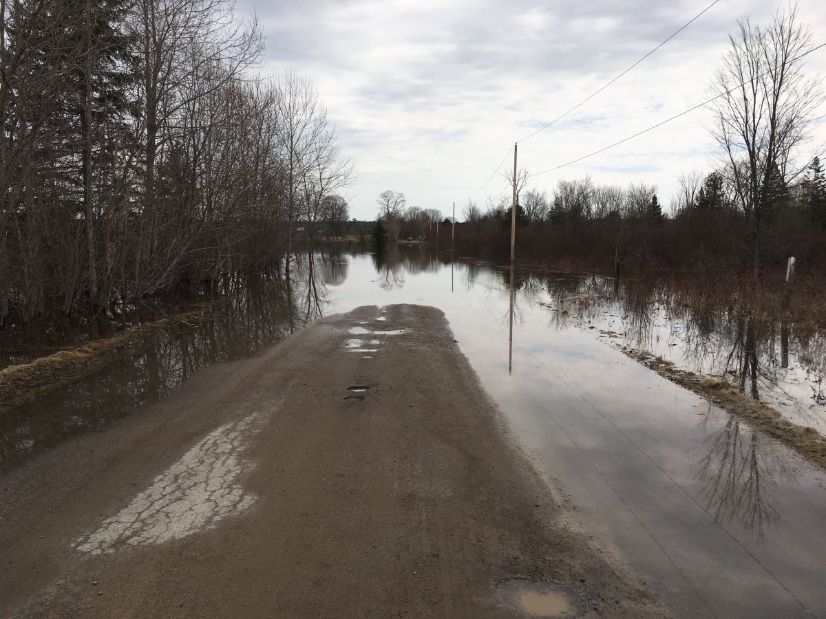
The rising water have also caused flooding on numerous municipal roads.
On Monday morning, the City of Kawartha Lakes stated the following roads were closed:


- Burnt River Road coming in off the north end at 121
- Pinery Road from Winchester to Burnt River Road
- Part of Concession Road 9
- Shuttleworth Road
- Crooked Court
- 3rd Road Somerville
- 9th Concession Burnt River from County Road 121 to #59
- Monck Road 45 from Kinmount Road 121 Norland to Highway 35 due to culvert failure
- Black River Road at Chisholm Trail Road and Cooper’s Falls Road (Muskoka 6) and to Lewisham Lane
The municipality is making sandbags available at the Burnt River works yard (filled bags available), Dalton Community Centre (13 Rumohr Dr.) and the intersection of Chisholm Trail and Brooks Lane near Black River.
Kawartha Lakes Fire Rescue held an emergency meeting on Monday morning to discuss how to tackle the situation.
The Otonabee Region Conservation Authority on Monday also re-issued a flood warning for the Peterborough region that will remain in effect until Friday.
- Be ready ‘for anything’ after wildfires hit telecom lines, official warns
- ‘Panic and anxiety’: Western Canada continues evacuations as wildfires rage on
- IN PHOTOS: Solar storm creates aurora borealis across Canada, world
- Northvolt should turn Quebec into a major EV player. So why are people so unhappy?
Comments