

The hot dog days of summer are back as heat pumps in.

Severe Thunderstorm Watch
Environment Canada has issued a severe thunderstorm watch for the Prince Albert, North Battleford, Lloydminster and Meadow Lake areas.
Conditions are favourable for the development of dangerous thunderstorms that may be capable of producing damaging wind gusts, damaging hail and heavy rain.
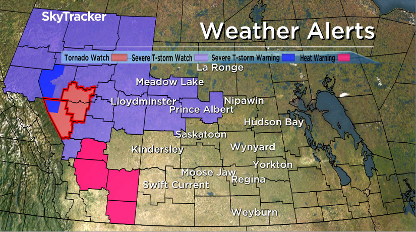
Thunderstorms are expected to develop Thursday afternoon and evening as a low pressure system tracks toward the region from central Alberta with some of these storms potentially becoming severe.
For the latest weather alerts download the Global News Skytracker weather app for iPhone, iPad or Android.
Saskatoon Forecast
Today
We cooled back to 13 degrees Thursday morning with mostly sunny skies starting the day.
Pure blue skies and sunshine helped warm us up into the mid 20s by late morning, feeling like 27 with humidity.
A moderate southerly wind with gusts upwards of 30 to 45 km/h will kick in this afternoon as we warm up to a high around 30 degrees under sunny skies.
Tonight
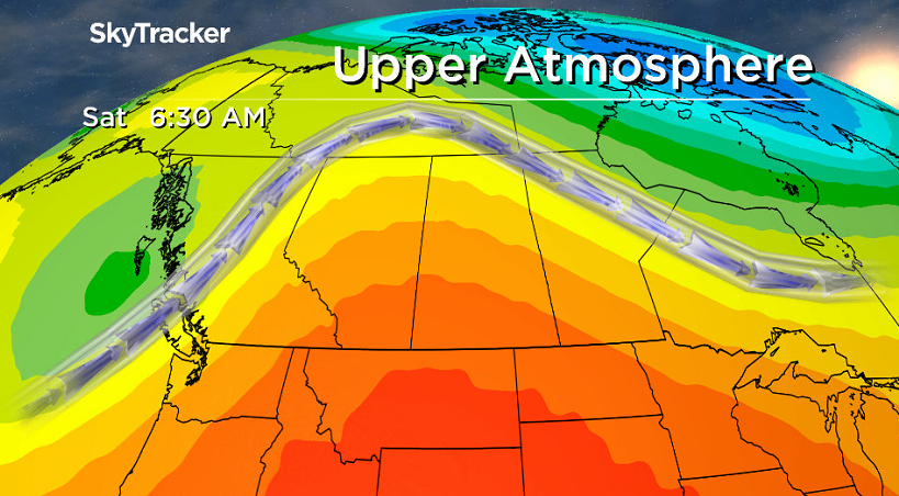
A low pressure system moving into north-central Saskatchewan tonight will bring with it a good chance of severe thunderstorms, particularly in western Saskatchewan with heavy rain, damaging hail and wind as the main threats.
The evening will start off with mostly clear skies in Saskatoon with a slight chance of showers and the risk of a thunderstorm overnight as the associated trough swings through and we cool into the mid-teens.
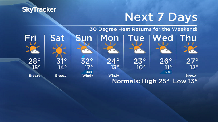
Friday
Slightly cooler air will slip in behind this system on Friday, however the morning will start off with sunny skies with a few clouds building in later on.
A cool northwesterly wind with gusts of 30 to 40 km/h into the afternoon will hold our daytime high back from reaching the 30s, only expected to reach around 28 degrees later in the day.

Weekend
After that brief blip on Friday, our warm upper ridge of high pressure builds back in the sunshine and hot temperatures on Saturday with a daytime high back in the low 30s.


A trough swinging through on Sunday looks to keep us in the clouds with a chance of showers to start the day, then we’ll likely get into some clearing before more clouds bubble up with a risk of thunderstorms later on as we climb to a daytime high in the low 30s again.

Work Week Outlook
A cold front will push through the area on Monday, which will drop us back into the mid 20s with windy conditions for the first half of the work week under a mix of sun and cloud.
Scot Johnson took this Your Saskatchewan photo near Île-à-la-Crosse:

Saskatoon weather outlook is your source for Saskatoon’s most accurate forecast and is your one stop shop for all things weather for central and northern Saskatchewan with comprehensive, in depth analysis that you can only find here.
- ‘Shock and disbelief’ after Manitoba school trustee’s Indigenous comments
- Invasive strep: ‘Don’t wait’ to seek care, N.S. woman warns on long road to recovery
- Grocery code: How Ottawa has tried to get Loblaw, Walmart on board
- ‘Super lice’ are becoming more resistant to chemical shampoos. What to use instead
Comments