
Monday, May 22, 2017 – Weather forecast update at 4pm:

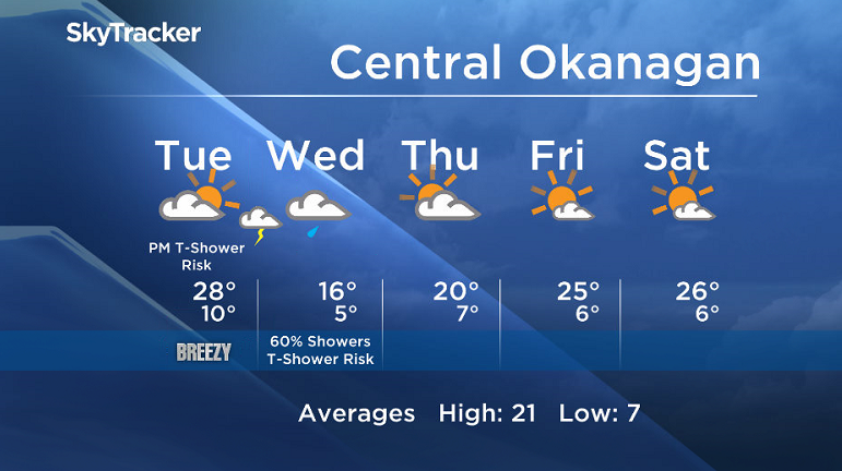
Enjoy sun to start on Tuesday, however a change is on deck by Tuesday afternoon with increasing cloud and breezy conditions.
A cold front will sweep across Southern BC and bring the chance of showers and thundershowers starting late Tuesday and Wednesday. All areas will see this threat of active weather, however the northern and central valley regions will see a moderate to high chance of precipitation, while the southern regions will only see a low to moderate risk.
In its wake we will see clearing on Thursday. As another upper ridge builds in for the weekend, expect summer conditions to return by the end of the work week.


Watch out for high water levels.
Tuesday’s daytime high range: 23 to 31C
We will have the rest of your weather details coming up at 5 and 6:30 and 11pm – Hope you can join us!
~ Duane/Wesla
- Toronto Pearson gold heist: Ontario man arrested at airport after arriving from India
- Capital gains changes could have ‘irreversible’ effects, business groups warn
- A ‘zombie’ virus is raging among raccoons. What to know
- Could notwithstanding clause be used on abortion? Poilievre’s office says ‘never’
Comments