
Friday, February 17, 2017 – Weather forecast update at 5pm:

A persistent southwesterly flow aloft will bring in multiple bands of precip to our region over the next few days.
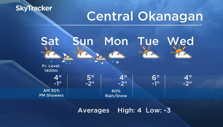
Most areas will be dry to start on Saturday but showers will move in by the afternoon. Freezing levels will be near 1400m this weekend, and higher elevation mountains passes will see some snow near summit levels.
Breaking news from Canada and around the world
sent to your email, as it happens.
The precip will taper off on Sunday, but another system moving in Sunday night will bring back the rain and snow.


The unsettled weather pattern will stick around until early next week.
This weekend’s daytime high range: +2 to +8C
We will have the rest of your weather details coming up at 5 and 6:30 and 11pm – Hope you can join us!
~ Duane/Wesla
More on Canada
Comments