
Friday, January 13, 2017
Weather forecast update at 4:45pm:

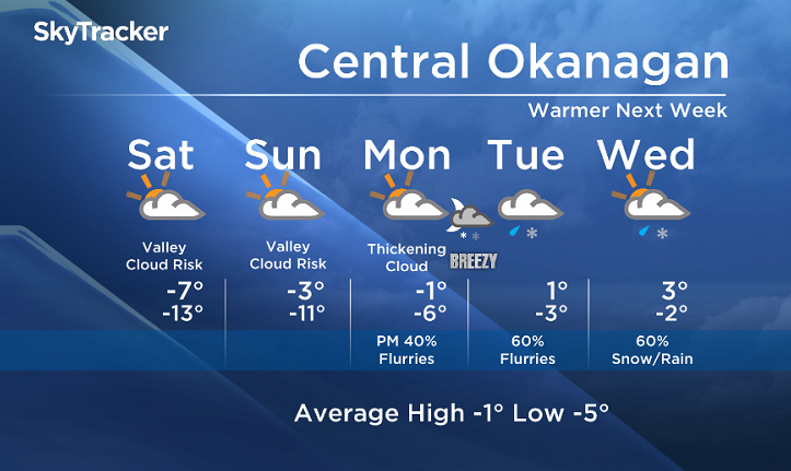
Welcome to your weekend! With the inversion still in place over the weekend, low lying cloud will continue to be a risk, especially in the morning hours. However as that milder air moves in aloft, it will gradually mix down to the valley bottoms, and we are expecting temperatures to return back to seasonal after the weekend.
A switch to a southwesterly flow aloft will also direct systems into the region next week, with a chance of precipitation returning to area by late Monday. With freezing levels rising, we will likely see the mix of rain and snow by next Wednesday, however there is uncertainty on the timing


This weekend’s daytime high range: -10 to -2
We will have the rest of your weather details coming up at 5, 6:30 and 11pm – hope you can join us!
~ Duane English / Wesla Wong
Comments