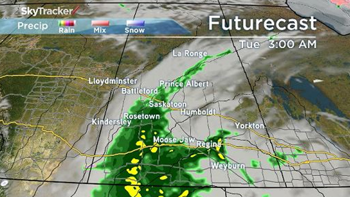
Rain is coming, with parts of southern Saskatchewan under a rainfall warning, but unfortunately, it’s eluding the places that need it most. The major story for the past several weeks, even before the tragic events in Fort McMurray, has been the fire danger.

The Canadian Wildland Fire Information System paints a picture like this for the present:
READ MORE: Sask. officials watching Fort McMurray wildfire approach border
The extreme danger zone arcs from Lloydminster, up to Île à la Crosse, and back down to Melfort. For the north, the yellow zone marks a high potential for fire danger. The entire extreme area – and the band of high or less to the south thereof – is, however, in for some respite.
The totals jump even higher in the far south, where Environment Canada has issued a rainfall warning.
The area from Moose Jaw to Swift Current and south to the U.S. border is under the warning, with 50 to 80 mm of rain expected over the next 48 hours.
But what about the far north?
We see in the image above a tendril of rain that barely gives La Ronge a taste, let alone communities like La Loche and Buffalo Narrows, who still sit under an air quality health advisory issued by Environment Canada.
For them, will help come in the next 48 hours? The short answer is “yes,” but in an expected way.
With fires, there is a 30/30/30 rule. This puts the following stipulations on extreme fire conditions:
- winds in excess of 30 km/h;
- temperature greater than 30 degrees; and
- humidity factor of less than 30 per cent.
Northern communities will meet none of these over the next little while.
FULL COVERAGE: Fort McMurray Wildfire
Temperatures have fallen drastically, now broaching single-digit highs, as high pressure from the Yukon duels our rainy low pressure system, keeping conditions clear and, thankfully, winds low.
You’ll also notice a trend of northerly and northwesterly wind, which we’ll be keeping an eye on, as that may impact Saskatoon’s Air Quality Health Index (currently, it’s at 2).
So, while wetter weather would be the better bet for producing a reduced fire warning forecast, for now, northern communities will just have to settle for an extra layer and, ideally, a personal fire ban.
Rainfall warning for:
- Swift Current – Herbert – Cabri – Kyle – Lucky Lake
- Moose Jaw – Pense – Central Butte – Craik
- Assiniboia – Gravelbourg – Coronach
- Shaunavon – Maple Creek – Val Marie – Cypress Hills


Comments