

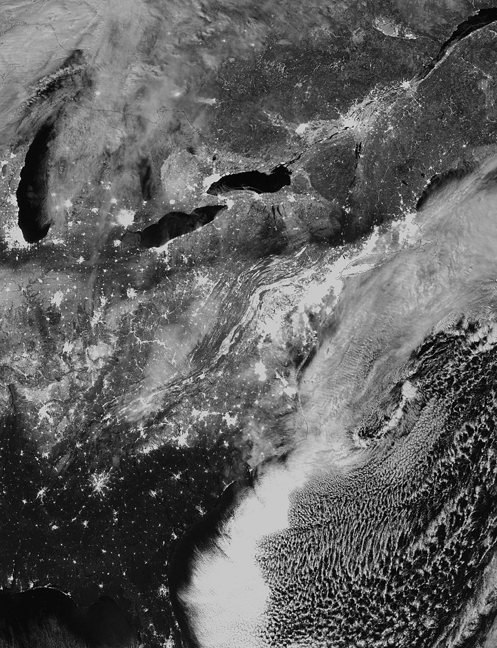
It was a blizzard that crippled the eastern United States, bringing major cities to a standstill. And while it was pretty impressive on the ground, it’s even more impressive from space.

NASA has released several photographs of the mega storm, which is responsible for killing at least 31 people.

More than 70 cm of snow fell in Boston, setting a new record. Close to 12,000 flights were cancelled over the weekend and more cancellations were expected on Monday.


The various NASA images were taken in conjunction with the National Oceanic and Atmospheric Administation (NOAA) using different light bands.
Fortunately, for Canadians, the bulk of the storm went out over the Atlantic Ocean. But for those that were in its path, the storm will likely be remembered as a true “Stormageddon.”
–with files from The Associated Press
- Invasive strep: ‘Don’t wait’ to seek care, N.S. woman warns on long road to recovery
- Ontario First Nation declares state of emergency amid skyrocketing benzene levels
- Do Canadians have an appetite for electric vehicles? Experts are divided
- Nearly 200 fossil fuel, chemical lobbyists to join plastic treaty talks in Ottawa
Comments