
Weather forecast update on Wednesday, November 11, 2015 at 4pm:

A strong westerly flow aloft will bring in a storm Thursday. Although most areas will see a drier start to the day, precip will move in midday.
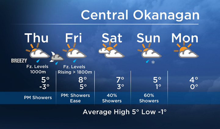
There is potential for the front to stall over parts of our region, keeping clouds and showers in the forecast until tomorrow morning.
Precip amounts will vary in the BC Southwest Interior, with the heaviest precipitation near the Columbia region.
Freezing levels will also vary between 700m in the Columbia and Shuswap to about 1000m in most of the Okanagan today. However with warmer air moving in, freezing levels will rise to at least 1800m by tomorrow for the Southern Interior.


Showers will ease Friday afternoon when the system exits.
Today’s daytime high range: 3 to 7C
We will have the rest of your weather details coming up at 5 and 6:30pm – Hope you can join us!
~ Duane/Wesla
Comments