


Weather update: Tuesday, October 27, 2015 at 4:15pm

High pressure on Tuesday kept weather systems away but our stable environment also inhibited the clouds to dissipate quickly. We were left with a very thick layer of clouds over the Central and the North Okanagan, while many parts of South Okanagan enjoyed brighter conditions.

Get breaking National news
Get breaking Canada news delivered to your inbox as it happens so you won't miss a trending story.
By providing your email address, you have read and agree to Global News' Terms and Conditions and Privacy Policy.
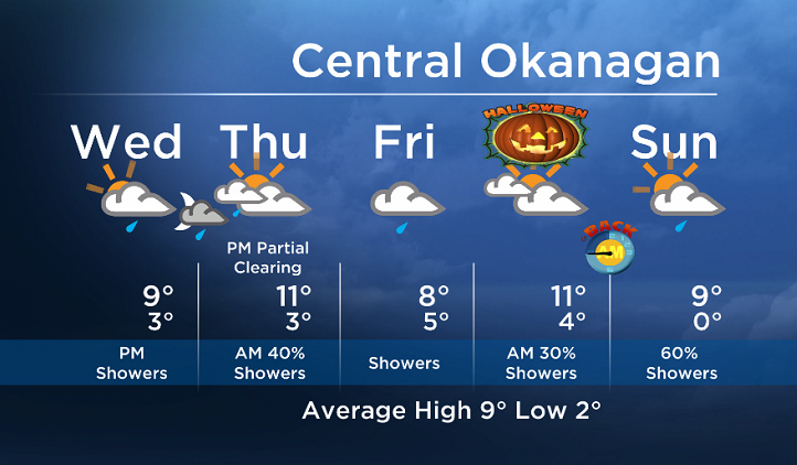
Starting Wednesday, multiple systems will start to move into BC. Showers will move across many parts of the Southern Interior Wednesday night and Thursday morning. On Thursday afternoon, we will be in between systems but another one will cross the area on Friday.
- Impact of extreme heat ‘underestimated’ on those 60 and older: Lancet study
- Has there been an increase in big earthquakes worldwide this year?
- Canadian wildfire season has “accelerated significantly”: officials
- Summerland residents begin returning home as roughly 1,200 properties cleared for re-entry


Wednesday’s daytime high range: 6 to 12C
We will have the rest of your weather details coming up at 5 and 6:30pm – Hope you can join us!
~ Duane/Wesla


Comments
Want to discuss? Please read our Commenting Policy first.