
Weather update: Thursday February 19th 4:15pm

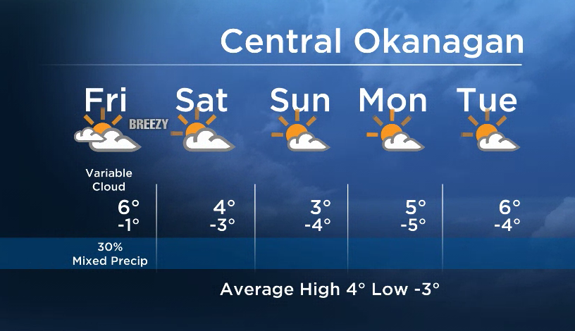
A northwesterly flow aloft is bringing mid and high clouds to the Southern Interior. This type of flow at the upper levels usually means that we will see a bit of everything in the forecast – clouds, breaks of sun, and the slight chance of precip as pockets of isolated precipitation are often embedded in this flow.
Cooler air will move in by this weekend when a stronger northerly influence is in place, dropping our temps back down close to seasonal for Saturday and Sunday. This will also bring drier air for the weekend, and more sun will return.


Another upper ridge builds in next week to bring us back to above seasonal temps by Monday or Tuesday.
Friday’s daytime high range: 3 to 8C
The rest of your weather details are coming up at 5, 6:30 and 11pm!
~ Duane English / Wesla Wong
Comments