
Weather update: Monday February 16th 4:15pm

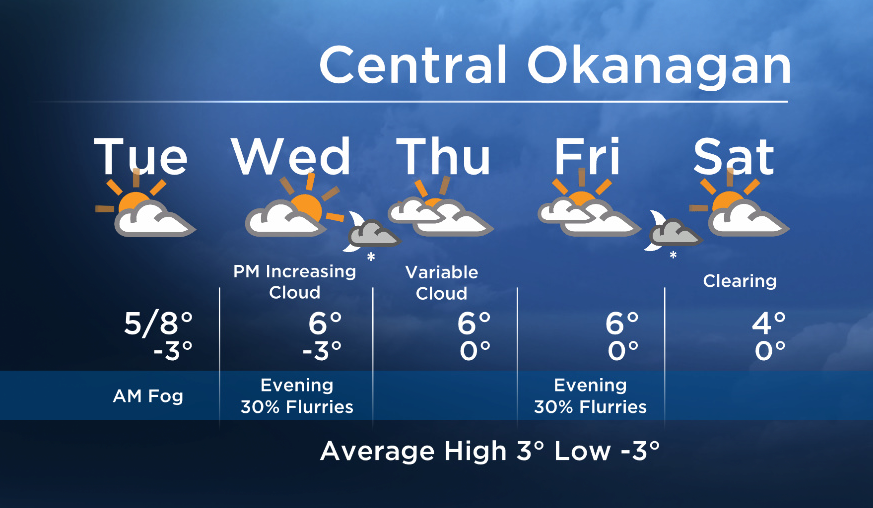
Cooling through the overnight hours will once again encourage the development of fog over bodies of water, however with daytime warming the fog patches will dissipate by the afternoon.
Breaking news from Canada and around the world
sent to your email, as it happens.
By late Wednesday an upper disturbance will swing across BC, bringing a slight chance of flurries to the area Wednesday night. This will also bring more cloud to our region for Thursday.
A ridge will rebuild over the Pacific for the weekend. We will be located on the east side of the ridge under a northerly / northwesterly flow aloft. This will help keep temperatures close to seasonal for the weekend.


More details coming up at 5, 6:30 and 11pm!
Tuesday’s daytime high range: 3 to 10C
~ Duane/Wesla
More on Canada
Comments