
After coming off one its worst winters in decades, Manitoba is now coping with historic flood levels – again.

The province is no stranger to flooding. Residents have coped with the water since the province was settled. But some of the worst documented flooding has occurred in 1950, 1997, 2009 and 2011.

The most recent flood, in the spring of 2011 is likely on the mind of southern Manitoba residents.
“We are going to see some scenarios that perhaps approach 2011 peak levels on some parts of the watershed,” Minister of Emergency Measures, Steve Ashton told reporters on Wednesday. “But this is a summer rainfall event.”
READ MORE: The rain has stopped, so why is Manitoba still flooding?
Statistically, the water levels in the Assiniboine River were estimated by meteorologists to occur once every 330 years. More than 7,000 residents were evacuated from their homes and three million hectares of farmland were flooded. A state of emergency was declared in 70 communities and 850 roads were closed.
What makes this past week’s flooding so different from the flood of 2011 is its timing: the flood of 2011 was due to a culmination of the fall rainfall and winter freeze of 2010 leading up to the spring thaw of 2011. This flooding event occurred in the first week of summer.
In 2010, southern Manitoba experienced its wettest year on record, including the weather bomb that dropped 50 to 100 mm of rain and snow at the end of October. When the ground froze, soil moisture levels were the second-highest on record.
During the winter — a winter that produced a 15-year high of snowfall — the snow that fell wasn’t able to soak into the ground.
Then spring rolled around.
The thaw was slow, but as the warmer temperatures rolled in, there was nowhere for all the rain that fell to go. Waters continued to climb across the Assiniboine, Souris and Qu’Appelle rivers, as well as the lakes. On May 9, the province declared a province-wide state of emergency.
But the factors leading up to this week’s flooding situation – which is expected to last for at least another week – are very different.
Instead of spring thaw, the culprit was a slow-moving, moisture-laden system that moved up from the south. That kind of system is more typical of a spring or fall weather pattern.
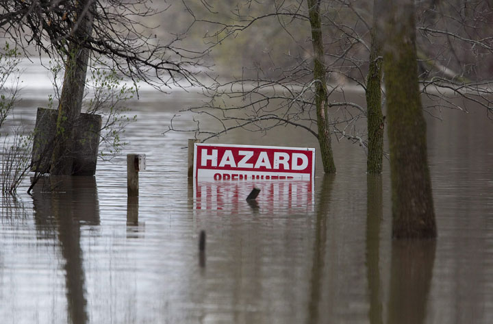
And that one system dropped record rainfall on many communities including Brandon which received 251 mm of rain. What made it more difficult is that the region has already seen three very wet months.
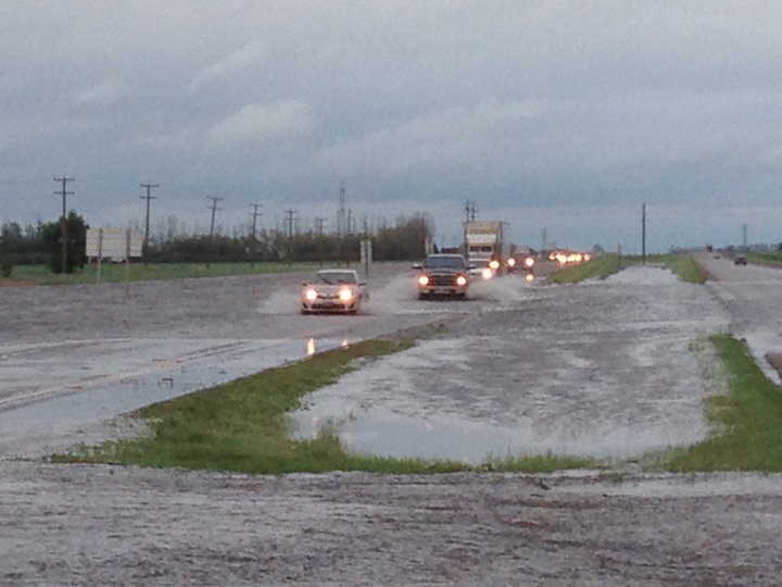
So far about 500 people have been evacuated in Manitoba’s communities, with another 300 in southeastern Saskatchewan. As of Thursday, 41 communities had declared a state of emergency in Manitoba.
READ MORE: About 500 people out of their homes as southwestern Manitoba floods
Fortunately, the wet weather came to an end by Wednesday.
“I said a couple of days ago, we’ve been looking for a break in the weather and this is the first real sign of a real break in the weather. And that’s absolutely critical, because, after three months of steady rainfall in this province – unprecedented rainfall – more than 200 per cent of normal, that will be a key factor, along with our flood management system.”
The cost
The floods of 2011 cost the province roughly $1 billion. Some may argue that it was money well-spent: many flood mitigation efforts, including the expansion of the floodway, were put into place across the province.
Lee Spencer, Executive Director of the Emergency Measures Organization said, “There’s been more done in terms of flood control since 2011.”
When it comes to the floods of 2014, Spencer said, “There is going to be significant damage to public infrastructure, both municipal and provincial roads. We will be assessing that over the next period of time.”
However, though the cost to infrastructure is still to be seen, the farmers are already facing a dire situation: Keystone Agricultural Producers (KAP) estimate that as many as 400,000 hectares of crop land have been left unseeded due to the persistent wet conditions throughout the spring and summer.
“Several sources in Saskatchewan say that the situation there is worse than in 2011, and now all of that water is heading to Manitoba to add to the already desperate situation producers and rural residents in our western region are facing,” said Doug Chorney, president of KAP said in a press release.
READ MORE: Farmers, communities tackle flooding as more declare emergencies
“In 2011, 3.5 million acres in the province were unseeded or flooded out, and I’m afraid that this could be the case again this year. Many farmers who did manage to get a crop in this spring are now seeing it under water, and that will only worsen when all of the water from Saskatchewan arrives.”
Ashton said that there are flood mitigation efforts under way and that without them they would be in a far worse condition.
“We are fully mobilized and I think in the classic Manitoba style here, we’re going to be working 24/7 to fight the flood.”
Comments