

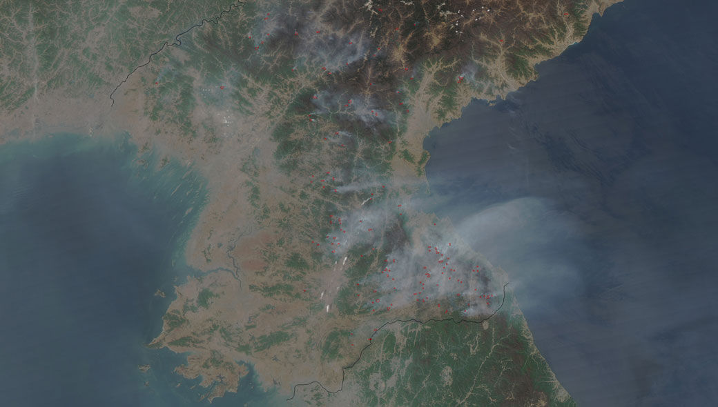
TORONTO – NASA has released a satellite photograph that shows dozens of fires burning in the southeastern parts of North Korea.

The image was taken on April 25 using the Moderate Resolution Imaging Spectrodiometer (MODIS) camera aboard the space agency’s Aqua science satellite.
Breaking news from Canada and around the world
sent to your email, as it happens.
MODIS is able to image in thermal bands, which allowed it to locate the sources of the fires. The fires seem to be originating from farming areas along rivers. Farmers often use fire to clear the debris from last year’s crops, which in turn helps to fertilize the soil.
However, some of the fires seem to be located in heavily forested areas, which may indicate wildfires.
The smoke from the fires was thick enough to spread over the sea of Japan.
Comments