Thousands were without power in the Maritimes, as the former Hurricane Lee moved into the region as a powerful post-tropical cyclone Saturday.

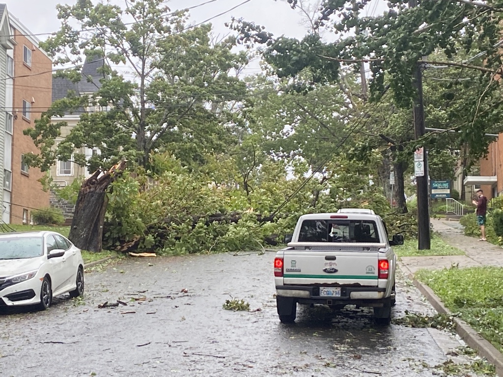
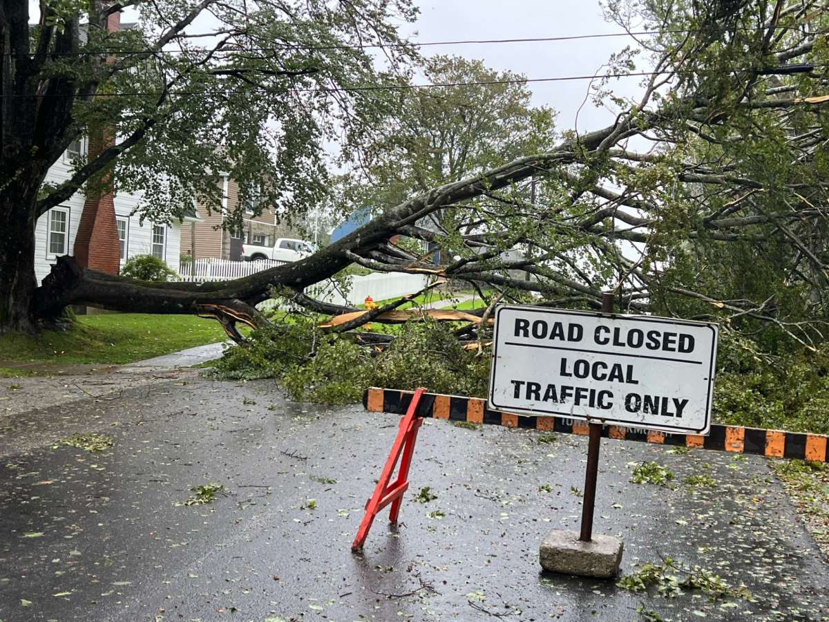
The storm packed a heavy punch — bringing strong winds, flooding and dangerous high coastal waves. Trees were down in some areas as well.
As of 6:00 p.m., Nova Scotia Power was reporting more than 143,000 customers without power, and NB Power was reporting over 25,000 customers in the dark.
Nova Scotia said the utility had 600 workers out in the field working to restore electricity.

“Crews have been able to restore power to some customers early this morning, however, conditions are getting worse,” Nova Scotia Power storm lead, Matt Drover, said in the release.
“In many cases, especially when winds are above 80 km/h, it isn’t safe for our crews to be up in the buckets, so we focus on assessing damage and restoring power from the ground where possible.”
On Saturday evening, Environment Canada confirmed that Lee had touched land over Long Island in Digby County.
“Lee will continue to impact the region tonight with rain or showers, strong winds, and high waves along the Atlantic coast,” the statement said.
The storm will continue to travel northward and cross the Bay of Fundy this evening.
In an afternoon release from Halifax Regional Municipality, it was noted that strong winds and rains are expected to continue throughout the evening in the area — with the most significant impacts being the storm surge.

“Of particular concern is tonight’s high tide, the peak of which will occur around 9 p.m.” the release said.

Get breaking National news
Global chief meteorologist, Anthony Farnell, said the timing of Lee’s arrival has been crucial for the region.
“There’s still a lot of offshore flow. So the wind is blowing out, which is good news for a lot of the fishermen in a lot of the areas right down by the water,” he said from Yarmouth, N.S.
“If this storm made landfall just a few hours earlier during a high tide, it would have added to that storm surge.”
Farnell went on to say the Halifax airport had reported 117 kilometres per hour winds, which is the highest numbers he had seen in the province.
“So that’s one of the reasons why there’s now widespread power outages. And it looks like right up until about 5 or 6 p.m., the worst of the winds and then slowly getting better and switching direction as we get into into dark tonight.”
Meanwhile, flights in and out of Halifax Stanfield International Airport had all been cancelled. The airport authority advised travellers to contact their airlines to reschedule any flights.
Halifax Regional Municipality closed Peggy’s Cove closed to the public Saturday. Pam Lovelace, the municipal councillor for the area, said some coastal roads were under water and several boats in St. Margaret’s Bay had been flooded.
Anxiety was high and people were worried, she said, especially as they’d already contended with devastating forest fires and disastrous floods earlier this year.
“People are exhausted … It’s so much in such a small time period,” Lovelace said in an interview. “From a mental health perspective, we’re asking people to check in on their neighbours.”
People were being asked to prepare to evacuate if needed, she added.
During a media briefing Saturday afternoon, municipal officials said there were multiple road closures and damage to infrastructure, including Peggy’s Cove Road, Shore Road in Eastern Passage and Lawrencetown Road.
Halifax Mayor Mike Savage said past hurricanes, the wildfires at the end of May, and the flash flooding in July have all contributed to the damage.
“A lot of our infrastructure was weakened by those. It may not have been destroyed at the time but it makes it much more susceptible to damage this time as well,” said Savage.
“It may not take as much to cause damage to roads, road beds, trees, things like that.”
Other areas of concern in the municipality were the Halifax, Eastern Shore, Bedford and Dartmouth waterfronts.
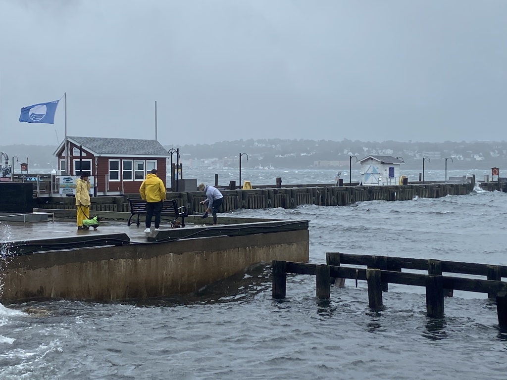
“Residents are advised to avoid shoreline areas as they pose an extreme risk, especially during peak tides,” the municipality wrote in a release.
“Residents are urged to remain off the roads for non-essential travel as there are several reports of downed trees and powerlines across the region.”
Despite the warnings, there were gatherings of people on the waterfronts and coastal areas. At one point, a man dressed in a full-body swim suit jumped into the harbour and then came out.
RCMP issued a warning to those deliberately heading to the waters to “watch the waves.”
“This action is putting themselves at risk along with First Responders in the event of rescue attempts,” wrote Nova Scotia RCMP on social media.
In an afternoon release, the Halifax Regional Municipality also noted an increase of both police and security presence on the Halifax Waterfront.
“Residents are reminded to respect posted signage and barriers in the area as the area is considered extremely dangerous,” the statement read.
There were multiple wind and rainfall warnings for Nova Scotia and New Brunswick — with more than 100 millimeters of rain expected to land in some parts.
As of late Saturday afternoon, Environment Canada said most of the rainfall alerts in Nova Scotia will end soon as “most of the rainfall has already fallen” throughout the province.
“Rainfall warnings are in effect for much of New Brunswick eastern regions of the Gaspe Peninsula, Anticosti Island and a portion of the Quebec Lower North Shore,” a statement read.
In New Brunswick, a hurricane watch was in place for Grand Manan Island and coastal Charlotte County, N.B.
Nicole Poirier, the vice president of operations at NB Power, said Friday that about 300 response crews had already fanned out across the province in anticipation of widespread outages.
Winds will ‘take time to dissipate’
Global’s chief meteorologist stressed that although Lee was a post-tropical cyclone, it still had hurricane force gusts that extended 600 kilometres from one side to the other.
“Even though the centre is weakening slightly, just that huge wind field is going to take some time to dissipate,” said Farnell.
“So that’s why it’s going to continue today and then even tonight, still rather breezy everywhere and tomorrow. Tomorrow is really when when the cleanup could begin.”
— with a file from The Canadian Press and Global News’ Mitchell Bailey


Comments