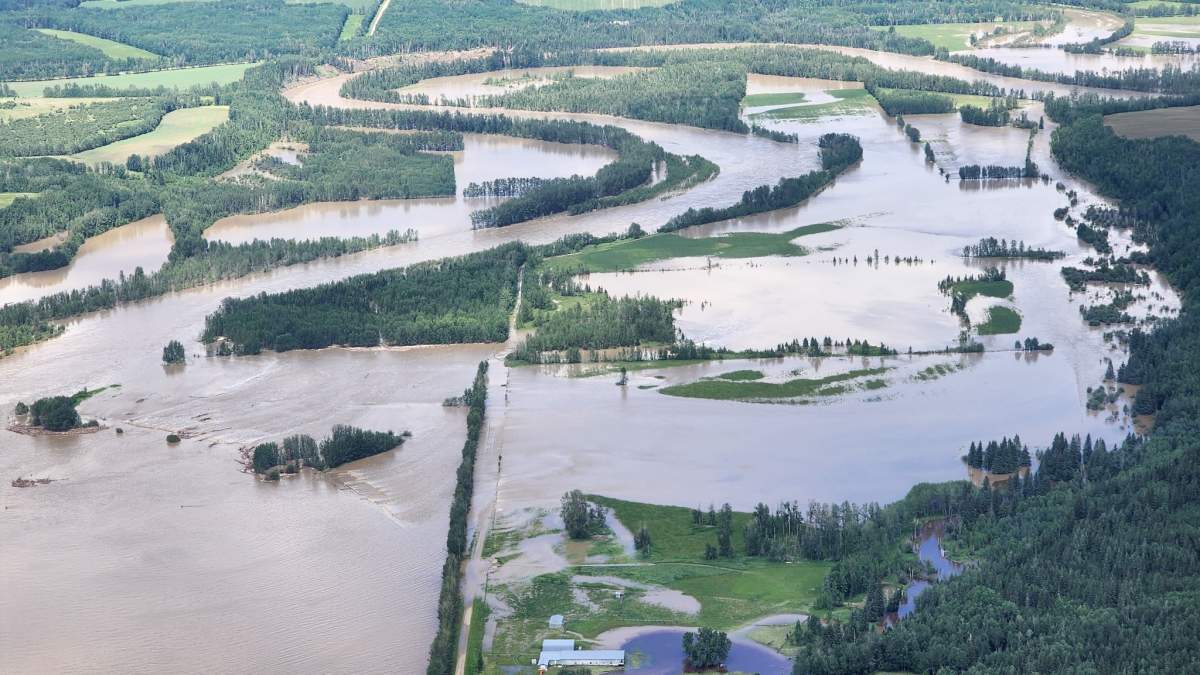
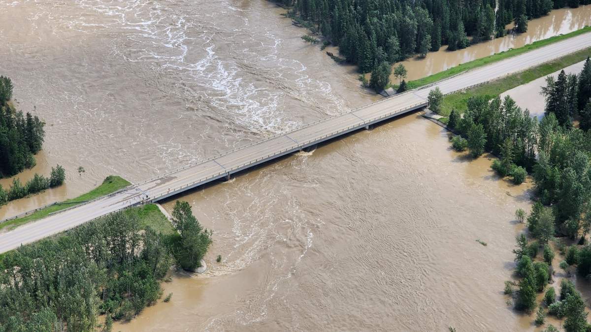
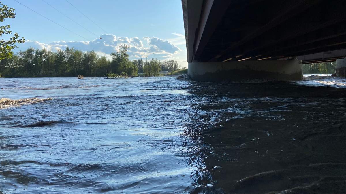
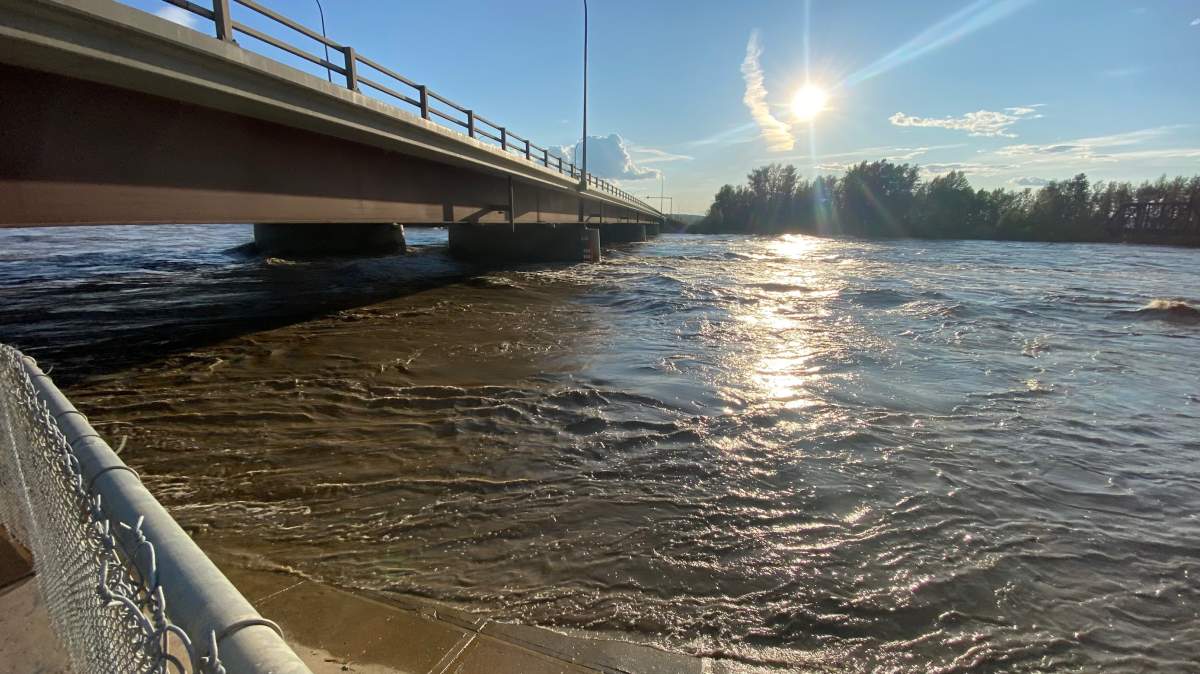
Multiple evacuation orders were issued Wednesday evening in Woodlands County, Alta., where both the McLeod River and Athabasca River have breached their banks, flooding lands and washing away roads.

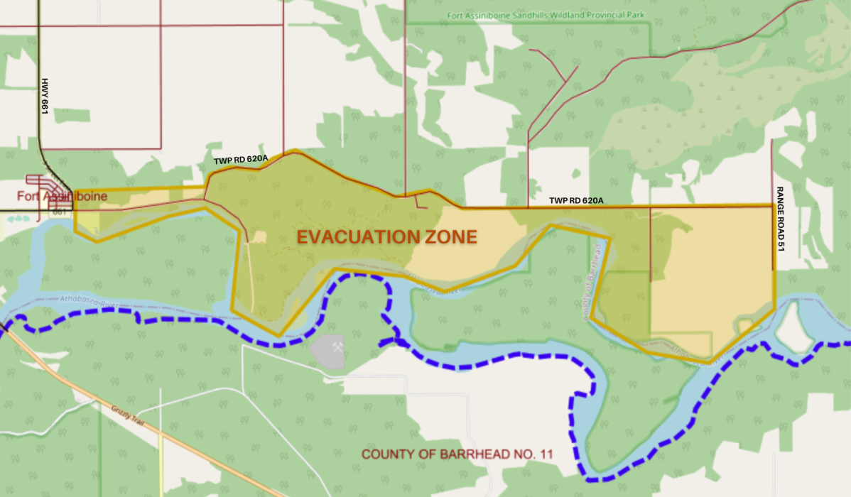
The orders affect both rural properties to the southwest and east of Whitecourt and properties further downstream near Fort Assiniboine.
The McLeod River merges with the Athabasca River at Whitecourt.
While the Athabasca upstream of Whitecourt has already peaked, Alberta Environment said late Wednesday afternoon the McLeod at the Highway 32 bridge is still rising. That is causing the Athabasca to rise downstream of the confluence.
The county said rising waters on both rivers are causing overland flooding and washing out roads.
Town of Whitecourt updates
The Town of Whitecourt said just before 8 p.m. due to rising water levels, Festival Park is closed to the public until further notice.
That included the off-leash dog park and the surrounding trail system in and out of Festival Park through to 47 Street.
Other public areas closed include:
– The pathway located under the Highway 43 McLeod River Bridge
– 47 Street north of Flats Road
– The Whitecourt Golf and Country Club
– Riverboat Park
Earlier in the evening, the town said there was an evacuation advisory alert for areas located along the McLeod River in Whitecourt, including Riverside Trailer Court.
No evacuation were required at the time but everyone in the affected area must prepare to evacuate with one hours’ notice.
There continues to be flowing water at Sagitawah RV Park, and the RV park remains on evacuation order.
Woodlands County evacuation order details

Get breaking National news
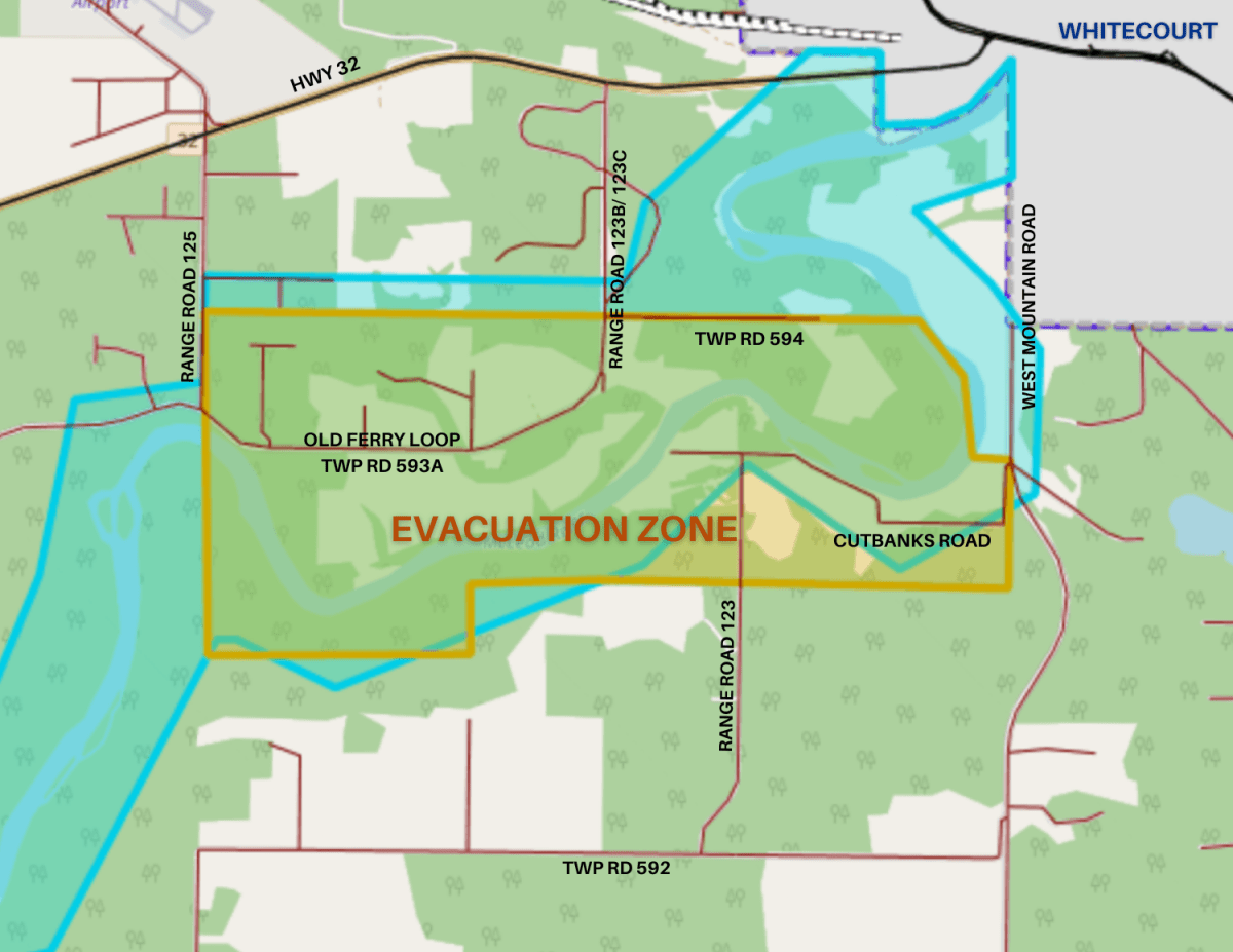
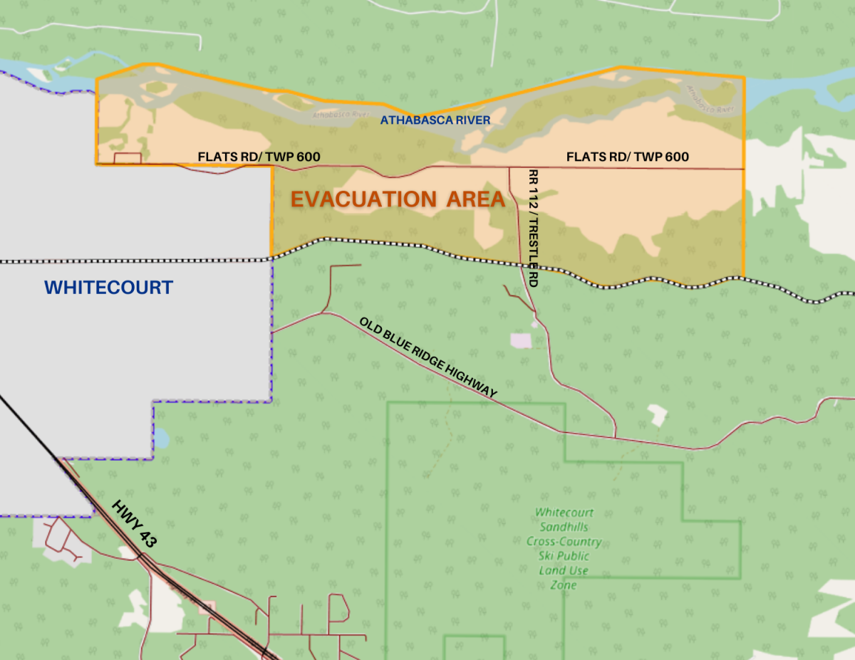
Just after 5 p.m., Woodlands County issued three Alberta Emergency Alerts in the span of about 15 minutes: first, for rural properties upstream of Whitecourt on the McLeod, and then shortly after that for two areas downstream of town on the Athabasca.
McLeod River flows are expected to peak late Wednesday evening at the earliest and remain high until at least Friday.
The first alert is in effect for everyone on Old Ferry Loop South and Cutbanks Road: Old Ferry Loop south of Township Road 594 to McLeod River, from Range Road 125 to Range Road 123B and west to McLeod River, along Cutbanks Road/Range Road 122, Range Road 123A, Range Road 593A.
The second alert is for effect for everyone in Woodlands County near Flats Road from town of Whitecourt boundary/Range Road 115 east along Flats Road and the Athabasca River south to the rail line.
A reception centre for both areas has been opened at the Woodlands County Office in Whitecourt. People are asked to go there or call 1-888-870-6315 to register.
Another alert is in effect downstream near Fort Assiniboine.
The county said an evacuation order has been issued for the Township Road 620a area along the Athabasca River, east of Fort Assiniboine.
Peak flows are expected in Fort Assiniboine Wednesday night and will remain high through Thursday.
A reception centre is set up at Woodlands County Fort Assiniboine Office until 9 p.m.
The province said Alberta’s River Forecast Centre continues to carefully monitor river levels, including rising or peak flows on the McLeod River and Athabasca River.
Everyone in the affected areas must evacuate immediately, gathering their pets, important documents and medications.
People are urged to travel with extreme caution, avoid driving through flooded areas and not move or bypass barricades.
Earlier this week some people in Whitecourt were under an evacuation order, however they were able to return on Wednesday.
Upstream from where the evacuation orders are, widespread flooding was captured in photos posted to the Yellowhead County Facebook page Wednesday evening.

View photos in the gallery below:









Comments
Want to discuss? Please read our Commenting Policy first.