
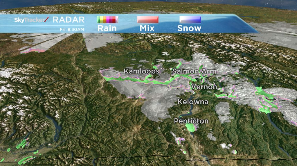

Current radar picking up precipitation in parts of the Okanagan.

Get breaking National news
For news impacting Canada and around the world, sign up for breaking news alerts delivered directly to you when they happen.
By providing your email address, you have read and agree to Global News' Terms and Conditions and Privacy Policy.
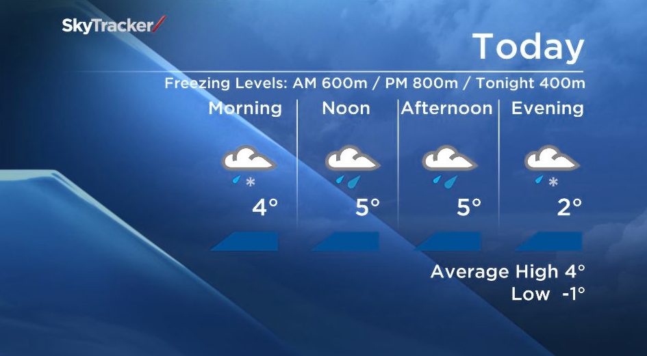
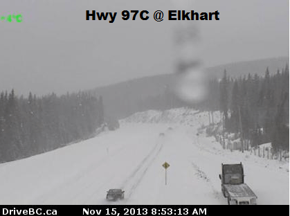
With freezing levels around 600m this morning, areas near the lake are seeing the precip fall as rain but areas on higher ground are seeing wet snow.
As snow levels rise to about 800m later today most areas except for the mountain passes will see rain fall, but the chance of flurries/wet snow remains in the forecast tonight when freezing levels lower down close to the valley bottom.
In the wake of this cold front we will see cooler temperatures Saturday.


Today’s High: 3 to 6C
Tonight’s Low: -1 to 2C
~Duane/Wesla
- Canadians involved in tourist bus crash in Dominican Republic, embassy says
- Canadians stuck in Middle East say cities ‘very tense’ as Iran conflict escalates
- Alberta mulls ditching time switch — again — as B.C. moves to permanent daylight
- In London, Poilievre pitches new UK, Australia, New Zealand partnership


Comments
Want to discuss? Please read our Commenting Policy first.