
Anyone who can is being asked to avoid travelling into or out of B.C.’s Southern Interior Tuesday.

An incoming Pacific frontal system is bringing a wave of snow to Interior mountain passes, and Environment Canada is suggesting motorists consider postponing non-essential travel until conditions improve.
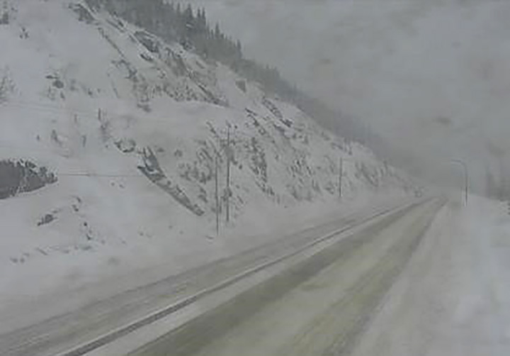
Affected routes include the Coquihalla Highway (winter storm warning), Highway 3 (winter storm warning and snowfall warning) and the Trans-Canada Highway (winter storm warning).
For the Coquihalla Highway, a winter storm warning is in effect between Hope and Merritt.
“Fifteen centimetres of snow has fallen near the summit of Coquihalla Highway,” said Environment Canada.
“Snow will continue this morning with an additional snowfall accumulation of 5 to 10 cm expected. The snow will taper off to a few flurries this afternoon.”
For Highway 3, a snowfall warning is in place from Hope to Princeton, via the Allison Pass, where 10 cm has already fallen and another 5-10 cm is projected before tapering off in the afternoon.

Get breaking National news
Further east, though, a winter storm warning is in place for the highway from Paulson Summit to Kootenay Pass, and the East Kootenay region as well.

“Heavy snowfall over northern sections of Kootenay Lake will taper off to a few flurries this afternoon, with total accumulations of 10 to 15 cm expected,” said Environment Canada.
“Southern sections, including Creston, can expect near 5 cm of snow.”


On Monday, for the Trans-Canada Highway, the national weather agency was forecasting 15-25 cm from Eagle Pass to Rogers Pass.
In related news, extreme cold warnings were also issued on Tuesday for the Peace River region and Yoho Park/Kootenay Park, where an arctic airmass will see wind chill values plummet to -35 C to -40 C Tuesday night and Wednesday night.
“Extreme cold puts everyone at risk,” said Environment Canada, adding that frostbite can develop within minutes on exposed skin, especially with wind chill.
“Dress warmly. Dress in layers that you can remove if you get too warm. The outer layer should be wind resistant.”

Comments
Want to discuss? Please read our Commenting Policy first.