
Arctic air will come charging into the Okanagan during the week before Christmas with the mercury in minus double digits all day Monday and heavy snow starting in the evening.

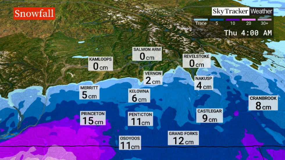
A snowfall warning has been issued for parts of the South Okanagan, Similkameen and Boundary region for up to 10 to 15 centimetres of snow by late Tuesday.

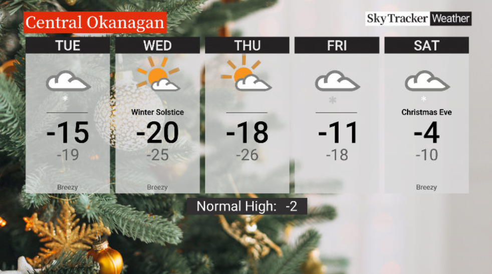
The risk of flurries eases through the day on Tuesday after five to 10 centimetres in the Central Okanagan with temperatures starting and ending the day in the minus teens.
Sunshine returns on Wednesday with the mercury sticks around -20 C all day before returning to the minus teens on Thursday.
The risk of snow returns to finish the week on Friday with a high continuing to head in the upwards direction.
A white Christmas is expected in the Okanagan thanks to the current snowpack being unlikely to melt with daytime highs Christmas Eve reaching around -4 C and more snow likely to fall.


Christmas Day will see temperatures get up to around 0 C with the risk of rain, snow and freezing rain.
Less than ideal travel conditions continue into Boxing Day Monday with the risk of more rain and snow and daytime highs staying above freezing.
For weather on the go download the Global News SkyTracker Weather App for iPhone, iPad or Android.
- Life in the forest: How Stanley Park’s longest resident survived a changing landscape
- Bird flu risk to humans an ‘enormous concern,’ WHO says. Here’s what to know
- More youth are seeking EI amid rising unemployment rates: StatCan
- Mental health support still lacking 4 years after mass shooting: Nova Scotia mayor
Comments