
Heat warnings continue in the Okanagan as the hottest days of the year slide in.

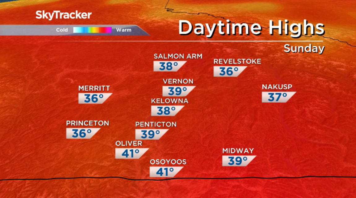
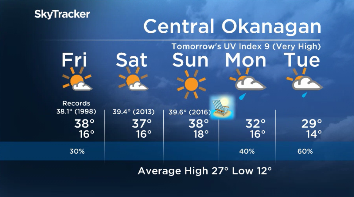
Temperatures are slated to soar to 38 C or 39 C on Thursday afternoon, and will likely break the previous record in Kelowna of 37.2 C from 1934.

Mostly sunny skies will stick around through the day, with the potential for showers and isolated thunderstorms along mountaintops, which could cause lightning strikes, potentially sparking new fires.
Sunshine then returns under a major ridge of high pressure, pushing afternoon highs up to around 38 C on Friday afternoon, and possibly breaking another record of 38.1 C from 1998.

Get daily National news
The heat and sunshine will stick around for the long weekend, with daytime highs around 37 C to finish July.


B.C. Day Monday will see the ridge start breaking down, with clouds and a chance of showers, plus a risk of a thunderstorm, as daytime highs slide toward the low 30s.
For weather on the go download the Global News SkyTracker Weather App for iPhone, iPad or Android.
Comments
Want to discuss? Please read our Commenting Policy first.