

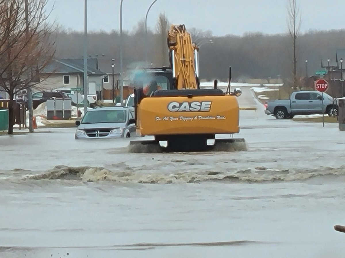
The Manitoba government said it will close Highway 75 south of Morris Monday as the list of municipalities under states of emergency due to rising floodwaters continued to grow.

In an update Monday afternoon the province said Highway 75 would close on the south side of Morris at 8 p.m.
The highway — the main route between Manitoba and the United States — was closed north of Morris on Friday. The province says a detour using Highway 3 through Carman and south to Winkler on Highway 14 will be set up during the closure.
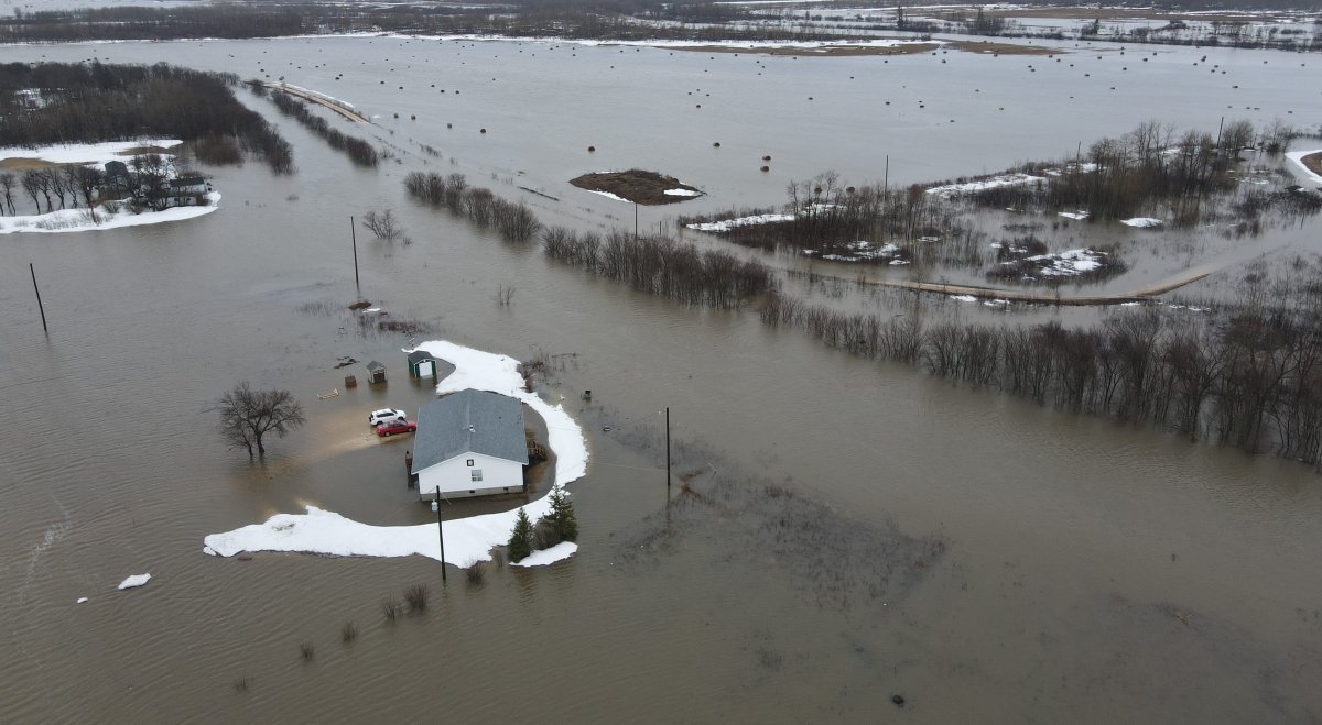
Communities in southern and central Manitoba continue to struggle with flooding after rainclouds delivered between 40 and 50 millimetres of rainfall in the Red River basin over the weekend, while areas of the Interlake and east of Lake Winnipeg received between 30 and 50 millimetres.

Provincial flood forecasters say the south could see flooding similar to 2009, the worst year for flooding in Manitoba since the so-called flood of the century in 1997.
They warn water levels are expected to remain high “for an extended duration” in many parts of south and central Manitoba.
As of Monday afternoon, 18 municipalities have declared local states of emergency, including:
- Rural Municipality (RM) of Cartier;
- RM of Morris;
- RM of Ritchot;
- RM of Fisher;
- RM of Montcalm;
- City of Morden;
- Town of Winnipeg Beach;
- Municipality of Pembina;
- Town of Arborg;
- RM of Armstrong;
- RM of Dufferin;
- Municipality of Bifrost-Riverton;
- RM of Grey;
- RM of Headingley;
- RM of Thompson;
- RM of West Interlake;
- RM of St. Laurent; and
- RM of Grahamdale.
Manitoba’s minister responsible for emergency measures said the Interlake region, which includes Peguis First Nation and Fisher River, is of the most concern.
“The snow really didn’t start melting. (It’s) a whole different, seemed like, climate,” Doyle Piwniuk said.

In Peguis First Nation, roughly 150 kms north of Winnipeg, evacuations have forced more than 1,000 people out of their homes, after ice jams on the Fisher River drove up water levels.
Residents from the community were sent to hotels in nearby communities, including Selkirk, Gimli and Winnipeg.
Chief and council of the neighbouring community of Fisher River Cree Nation, which remains under a provincial flood warning, issued a state of emergency over the weekend.
A community flood update posted online Monday afternoon said some high-risk residents were sent to other areas.
Meanwhile, an overland flooding warning remains in effect for the Interlake and portions of southern and central Manitoba.
A flood warning is in place for the Red River from Emerson to the Red River Floodway inlet and from the floodway’s channel outlet to Lake Winnipeg.


A flood warning already issued for the Assiniboine River has been expanded to include areas around the Shellmouth Dam to Brandon.
South of Winnipeg, water rose to cover some rural roads, requiring people to leave before losing road access.
In the RM of Montcalm, roughly 81 kilometres south of Winnipeg, 27 homes have been ordered to evacuate affecting 69 people, with further evacuations expected in the coming days.
The Manitoba government said some regions received four to six times the normal amount of precipitation in April, much of it in the form of snow that was melting at the same time as heavy rains fell on the weekend.
Since April 1 the province says southern and southeastern Manitoba and the United States portion of the Red River basin have received 120 to 160 millimetres of precipitation, some 400 to 600 per cent more than normal.
The weather forecast contained some good news though. Dry, warm weather was predicted for the remainder of the week.
The Red River Valley, including Winnipeg, Morris and other areas, is largely protected by community dikes and diversion channels that were expanded after the 1997 flood.
Communities and homes in the valley are protected to a water level 60 centimetres or more above the 1997 peak.
In Monday’s update, the province said the floodway and the Portage Diversion continue to operate to lower water levels in Winnipeg.
Flows in the floodway channel were 38,300 cubic feet per second (CFS) Monday morning, the province said, with flows upstream of the floodway inlet hitting 74,000 CFS.
— with files from The Canadian Press

Comments