
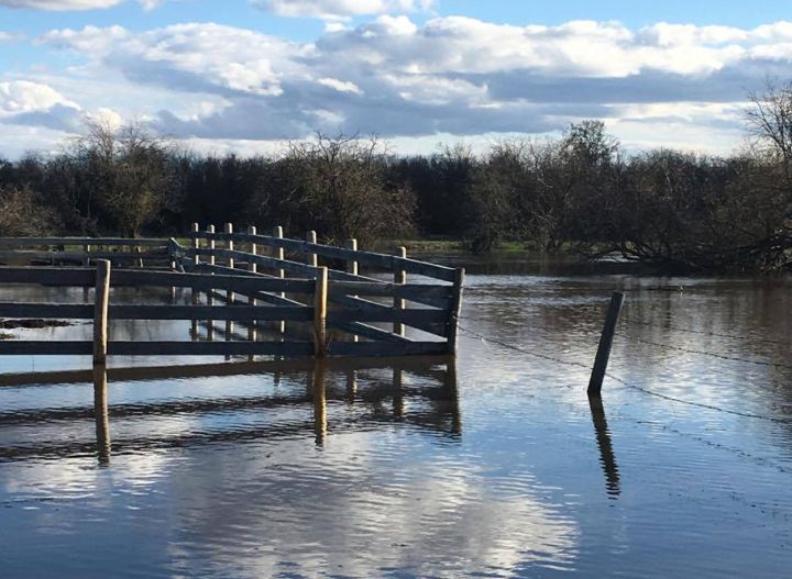
It’s that time of year when many residents across the province feel their senses tingling in anticipation of flood season.

There are seven major watersheds in Alberta, each behaving in its own way following major rainfall events or during the spring snowpack melt and runoff.
The Peace/Slave River watershed, Athabasca River watershed, North Saskatchewan River watershed and South Saskatchewan River watershed are all greatly influenced by a combination of spring runoff and major rainfall.
Read more: By the numbers: 2013 Alberta floods
Climate data from May and June confirm that both months provide much of the annual rainfall in these watersheds, a situation that amplifies flooding potential when any stretch of above seasonal temperatures in the mountains can accelerate snowpack melting.
While these combined situations are in constant flux and require continuous monitoring in order to be prepared for emergency flood mitigation, the province does offer weekly comments in the spring regarding flood potential.

Get breaking National news
The latest comments were published by Alberta Environment and Parks on May 6 and are as follows:
- Battle River Basin: Water courses are generally below the normal range.
- Bow River Basin: Water courses are generally within to slightly above the normal range.
- Milk River Basin: Water courses are generally within to slightly above the normal range.
- North Saskatchewan River Basin: Water courses are generally within the normal range.
- Oldman River Basin: Water courses are generally within to slightly above the normal range.
- Swan Hills Basin: Water courses are generally normal to slightly below the normal range.
- Red Deer River Basin: Water courses are generally normal to slightly below the normal range.
- South Saskatchewan River Basin: Water courses are generally within to slightly above the normal range.


Alberta Environment and Parks also provides spring updates on river ice formations and spring breakups. The most recent comments suggest that river ice breakup is now complete on both the Peace River through to the confluence with the Slave River.
Meanwhile on the Athabasca River, ice blockages observed in early May have been seen to break up in Fort McMurray more recently and remaining ice cover has weakened enough for open flow to resume. The province reports that water levels have remained low, rising less than 30 cm as the ice passed by last week.
It should be noted that there are no river or flood advisories in place at this time. The next update from the province is expected this week.
Want your weather on the go? Download the Global News Skytracker weather app.
Comments
Want to discuss? Please read our Commenting Policy first.