
After a windy finish to the weekend, with a cold front passing through bringing in the first batch of clouds in just under one week on Sunday, slightly cooler air arrived to start the week.

Sunshine returned to the valley Monday morning with temperatures just shy of the freezing mark before the mercury made its way up into the high teens under clear skies into the afternoon.

20 degree heat returns to the region as an upper ridge strengthens on Tuesday, keeping skies sunny during the day.
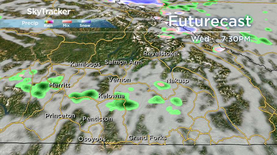
The pattern begins to break down with a return to more clouds on Wednesday with one more 20 degree daytime high with the chance of showers in the evening as a cold front slides through.

Get daily National news
The work week will finish on an unsettled note with the chance of showers Thursday and lingering clouds on Friday as afternoon highs return to the mid-to-upper teens.


Unsettled conditions are likely to linger into the weekend with a chance of showers and daytime highs staying in the teens.

For weather on the go download the Global News SkyTracker Weather App for iPhone, iPad or Android.
- Jasper mayor says CN Rail relocation will be devastating: ‘Deeply disappointed’
- Retired Quebec teacher buys winning lottery ticket at last minute, wins $40M
- N.B. election: Higgs went to ‘very dark place’ with Liberal joke, opponent says
- GM, Volvo, Land Rover vehicles among those in big recall. What to know


Comments