Oh, to be a weather forecaster on days like these — so fun but super stressful because there is always so many factors at play. Nonetheless, here’s what we are forecasting.

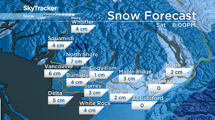
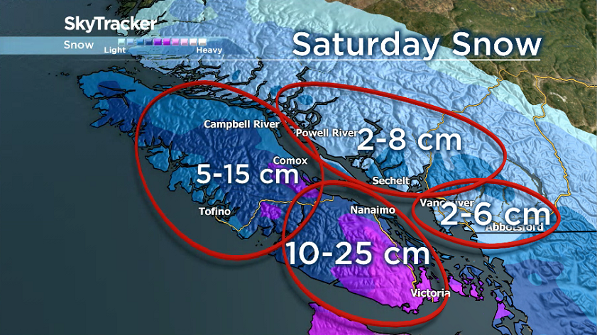
Tobogganers rejoice! Drivers beware! Saturday’s snow event will likely be just several centimeters for the Lower Mainland but it could be enough to have fun and cause problems. At the very least, we could see more snow than what we’ve received so far this winter at least, with a chance for 2-6 cm.
The timeline for this 2-6 cm for the Lower Mainland is tricky. It can take a while to scour out the dry arctic air that is in place. Snow may fall at higher elevations for several hours but have a hard time reaching the ground and accumulating much. So although we may see snow fall Friday night and Saturday morning, the majority of our accumulations may not occur until late morning or early afternoon.
The areas we will be watching for major snow and problems are across Vancouver Island, specifically the southern part of the island.

Get breaking National news
Environment Canada has issued winter storm warnings for the Greater Victoria region extending out to areas like Sooke, the Malahat from Goldstream to Mill Bay and the Southern Gulf Islands.
These regions can expect anywhere from 10 to 25 centimetres of snowfall between midnight Friday through Saturday morning. Driving conditions during this time will be dangerous due to rapidly accumulating snow and low visibility caused by strong winds blowing snow.
Areas further north on Vancouver Island are under a snowfall warning with 10 to 15 cm of snow possible.
The Lower Mainland is the toughest call in this type of weather scenario.
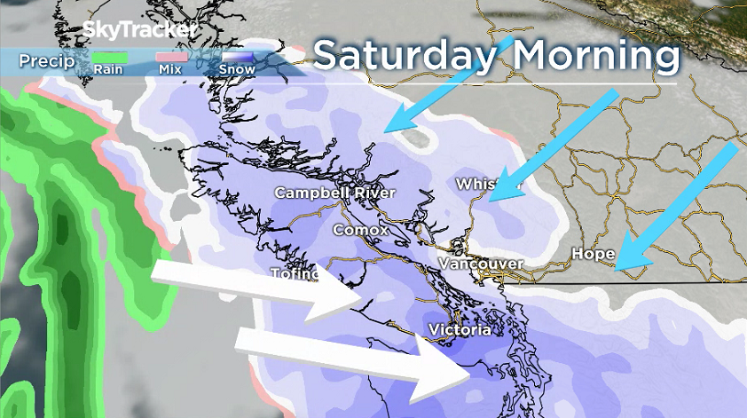
Here’s why: Saturday snow depends on who wins the battle between two air masses. On the left, the mild moisture-laden airmass moving in from the pacific. On the right, the dry, cold outflow airmass which is in place across the Lower Mainland. If the push from the pacific airmass is strong enough and the outflow over the Lower Mainland weakens, snow will be the outcome.
But right now, it looks like, the dry, cold outflow will put up quite a fight. This means, heavy snow is unlikely and a range of more moderate amounts from 2-6 cm is more likely. Most of the energy from the Pacific airmass will likely be diverted to the south.


Comments