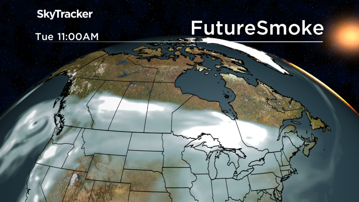
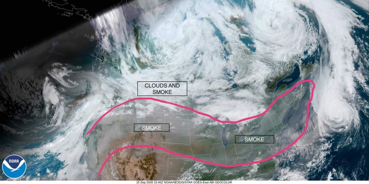
Smoke from U.S. wildfires burning in Washington, Oregon and California has made its way to western Canada and is having visible impacts on air quality in several provinces.

Grey skies and thick smoke have clouded parts of Manitoba and Ontario while most of British Columbia and Alberta continue to experience poor air quality brought on by the incoming pollution.

Anthony Farnell, chief meteorologist with Global News, said the fires “grew rapidly” over Labour Day weekend as record high temperatures collided with strong winds.
The smoke from the U.S. wildfires was initially blown west off the Pacific coast but then became trapped between a low and high area of pressure over the Rocky Mountains, he said, then made its way into the upper atmosphere, where it was pushed east.
“This is still creating very poor air quality for cities in the western U.S. and southern British Columbia and will remain a concern through the rest of the week,” said Farnell.
He said “milky white skies” were reported as far east as St. Johns, Newfoundland, while sunshine, filtered by smoke, has been lowering temperatures by “a degree or two cooler than it would normally be in many areas including southern Ontario and Quebec.”

Farnell added a majority of the country would experience little to no health concerns as smoke remained in the upper atmosphere.
“It will slowly disperse and continue travelling east towards Europe in the next couple days,” he said, but for now, several provinces in Canada will take on the brunt of the smokescreen.

Get weekly health news
Images and video of Alberta covered in smog have been making the rounds on social media.
On Tuesday, Environment Canada issued updated air quality statements to include Banff and Waterton Lakes National Parks, Canmore, Cardston, Fort Macleod, Magrath, Crowsnest Pass, Pincher Creek and Kananaskis.
All four air quality statements urged people to remain indoors, noting that increased coughing, throat irritation headaches and shortness of breath were all symptoms of smoke exposure.
Environment Canada said conditions in southern Alberta may get worse as a cold front moving through the province gets “pushed down to the surface,” but added air quality was expected to improve Tuesday evening as “northerly winds in behind the front will flush the smoke out of Alberta.”
In British Columbia, a thick haze has blanketed most of the province, causing Canada Post to temporarily pause its services in heavily affected areas.
Metro Vancouver previously warned the smoke was forecast to move north from the Pacific to overtake the entire region.
“Be prepared for possible darkened and orange skies,” they said.
Ken Reid, an environment modelling specialist with Metro Vancouver, previously told Global News the past week has ranked as being “some of the worst air quality that we’ve ever experienced in this region.”

A special air quality statement was issued last Tuesday for most of the southern half of the province including Nanaimo, Victoria and the Okanagan after smoky skies earned most of southern B.C. a 10+ rating, considered a “very high health risk” by the province’s Air Quality Index.
- Attorney general ‘not commenting’ on Ford’s call for Umar Zameer judge to apologize
- Iranian facing deportation for sanctions evasion tries to sponsor mother to immigrate
- Swan Hills, Alta.’s only pharmacy set to close on April 30
- Fishing fees increase as Saskatchewan introduces angling habitat certificate
Peter Kimball, warning preparedness meteorologist for Environment Canada, said the smaller smoke particles blanketing certain parts of Canada are considered hazardous in general, but particularly for those with breathing, respiratory or cardiovascular problems, including older adults, pregnant women and children.
In Ontario, where the skies have taken on a greyer look, Kimball said there was no cause for alarm.
“What we are seeing is the smoke aloft that has been transported way downwind by the jet stream all the way to Ontario and it’s it’s affecting our skies by making the skies look rather hazy, particularly early in the morning when the sun is low, and also in the evening at sunset,” he said.
While several parts of western Canada get socked-in with air pollution, meteorologists predicted it was likely to miss Manitoba.
Eric Dykes, an Environment and Climate Change Canada meteorologist in Manitoba told Global News in a previous interview that smoke had made its way to Manitoba, but “it’s aloft.”

“It’s giving us the kind of hazy skies we’re seeing around southern Manitoba today — if we didn’t have the haze it would actually be very, very sunny,” he said Monday.
“For the next little while we’re going to get through a couple days of hazy skies here in southern Manitoba, and then we get into more clearing and blue skies, and colder temperatures.”
As of Tuesday, there were no weather alerts in effect for Saskatchewan.
Foreshadowing?
The extreme weather seen in 2020 could serve as a “fingerprint or a blueprint for what is to come,” Environment Canada meteorologist Armel Castellan told Global News.
The drier spring and summer offered “potentially antecedent” conditions for wildfires to get hotter and more explosive than they have in previous decades, as well as larger and more difficult to fight.
“We’ve seen a lot of these fires are uncontrollable and lasting for many weeks, if not more than a month at a time. All of that is spelling that we could see this being a relatively small year when we consider what is to come in the decades to come,” he said.
“We might look back on 2020 and this smoke event and think, ‘wow, how mild of an event that was.'”


Comments
Want to discuss? Please read our Commenting Policy first.