Western University storm researchers have determined that a total of six tornadoes touched down in the London, Ont., region during Sunday’s severe thunderstorms.

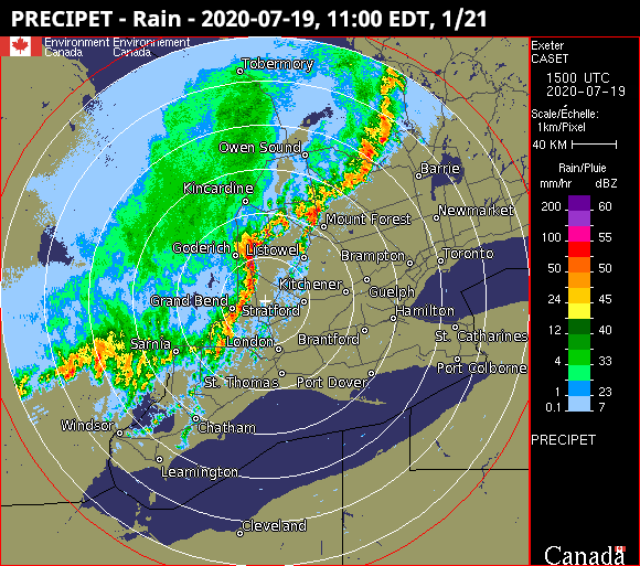
Survey teams with the university’s Northern Tornadoes Project (NTP) were dispatched this week to observe damage left behind by the storms that rolled through southwestern Ontario over the 11 a.m. hour Sunday, prompting tornado warnings for the area.
NTP officials confirmed earlier this week that an EF0 tornado touched down near Belmont, while two EF1 tornadoes touched down north of Lucan and in Beachville, west of Woodstock. The tornado near Lucan also produced a larger EF0 downburst.
On Tuesday, the team confirmed that a fourth tornado, also rated EF1, had touched down in Gads Hill, a small community about 10 kilometres northeast of Stratford.
It was later confirmed on Wednesday that two EF1 tornadoes had also touched down, one near Blyth, and one in Lambton Shores just east northeast of Sarnia.
The Belmont tornado had a preliminary path length of 9.3 kilometres and maximum sustained winds of 125 km/h, while the tornado near Lucan travelled 2.4 kilometres and had maximum sustained winds of 135 km/h.
The tornado near Woodstock, meantime, had a preliminary path length of 2.8 kilometres, a width of 100 metres and maximum sustained winds of 150 km/h, while the Gads Hill twister travelled 4.2 kilometres, and had a width of 400 metres and winds of 150 km/h.
Near Blyth, the tornado there travelled some 6.7 kilometres, was 50 metres wide, and had maximum winds of 135 km/h.
The tornado that touched down in Lambton Shores stands as the most intense of the outbreak, with maximum sustained winds of 155 km/h. Officials said it travelled 15.4 kilometres and had a width of 200 metres.

Sunday’s storms produced damage across southern Ontario.

Get daily National news
“We’ve got damage reports all the way from Tilbury to Huntsville,” said Dave Sills, NTP’s executive director, in an interview on Monday with 980 CFPL’s Jess Brady. “That’s a huge area that experienced scattered damage.”
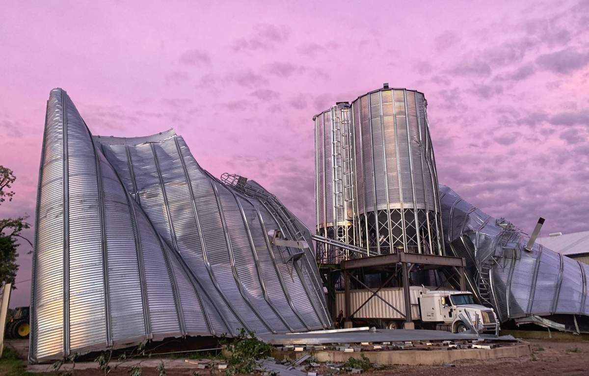
Near Belmont, Environment Canada reported downed trees, roof damage and a camper trailer that had been pushed into the side of a house, while trees, farm buildings and silos were damaged near Exeter and Lucan.
In Beachville, Environment Canada reported a large tree down and damage to a roof, while in Woodstock, damage was reported to a barn and a shed on Oxford Road 4.
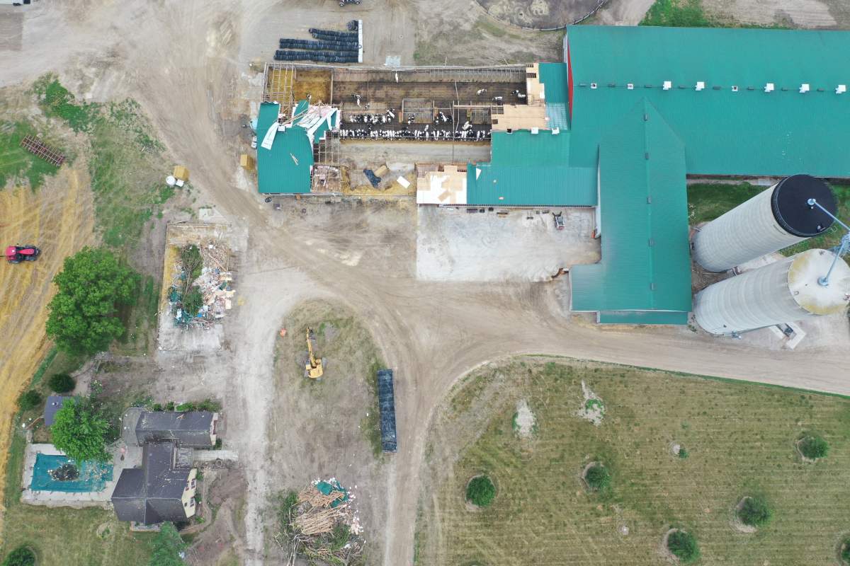
Near Blyth, trees were uprooted or snapped, while in Lambton Shores, a dairy farm in Thedford saw a dry shed destroyed and a dairy barn heavily damaged. A nearby turbine also lost several blades.
Sills likened investigating the events to “meteorological CSI.”
“There were no pictures of a tornado over land. Anything that happened was in the rain, so it only leaves us to look at the patterns of damage,” he said.
“Thankfully, it’s not that difficult to see the differences between the damage caused by a tornado and the damage caused by a downburst.”
Researchers also found no evidence that a waterspout spotted over Lake Huron north of Sarnia made landfall.
As of Wednesday, a total of 10 tornadoes have touched down in the London region in the last month and a half.
Four tornadoes were confirmed to have touched down on June 10 near Belgrave, Brussels, Glencoe and Belmont, in that order.
The tornado that touched down near Belmont was found to be an EF1-rated tornado, while the others were rated EF0, all on the lower end of the Enhanced Fujita scale, which goes up to EF5 on a scale of severity.
The four were among at least seven tornadoes that touched down that day in southern Ontario. Three others were confirmed in cottage country — Bracebridge, Mary Lake and Baysville.
Environment Canada says it also received reports of storm damage Sunday in London, including downed trees.
In Grand Bend, flooding was reported along River Road at the marina and on the nearby main pier, while damage was reported to trees, sheds and a garage in Stoney Point.
In Burlington, a large tree limb landed on top of a vehicle, and in northeastern Ontario, a tree was reported to have fallen onto a house in North Bay.

The purpose of the NTP, launched in 2016 and expanded in fall 2019, is to report and catalogue every tornado that touches down in Canada.
To meet that mighty goal, the project utilizes planes, drones and high-resolution aerial and satellite imagery to find tornadoes in more remote areas that would otherwise go unreported.


Comments