
The Shuswap River appears to be stabilizing, but one North Okanagan community is reminding residents to still stay clear of fast-moving bodies of water.

On Friday, the City of Enderby said though localized flooding continues to occur, the Shuswap River has gone down recently.
It said the river’s current flow rate was 374 cubic metres per second, along with a level of 4.465 metres. On June 15, the flow rate was 419 cubic metres per second, along with a level of 4.70 metres.
On June 5, the river was flowing at 459 cubic metres per second and featured a level of 4.920 metres.
“The B.C. River Forecast Centre is continuing to maintain a high streamflow advisory for the Shuswap River, as flooding at low-lying levels is occurring,” said the city.
“Please remember to stay clear of potentially unstable riverbanks during the high-streamflow period. If your property is or may become at-risk of flooding, please take appropriate measures to protect it.”

Get breaking National news
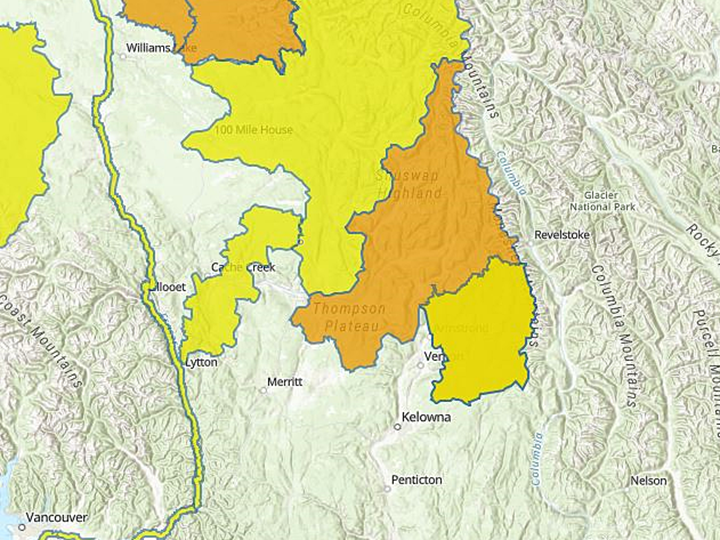
According to the B.C. River Forecast Centre, the high streamflow advisory covers most, but not all, of the North Okanagan.

The city said the Shuswap River is predicted to remain close to its current level for the next 10 days, though some changes are expected as forecasted rain makes its way through the drainage system.
It also said closures remain in effect for part of Waterwheel Street, part of Riverdale Drive, and the Kildonan boat launch.
Farther north, into the Shuswap Highland and Thompson Plateau, a flood watch is in effect.


Comments
Want to discuss? Please read our Commenting Policy first.