

A flood watch has been issued by the B.C. River Forecast Centre for parts of the Southern Interior.

Issued Thursday afternoon, the flood watch is calling for high rain this weekend.
In addition, Environment Canada has issued special weather statements for several regions, stating that strong thunderstorms late Saturday will be followed by significant rainfall on Sunday.
“A significant change in the weather will arrive on Saturday as a low pressure system enters B.C. from Washington state,” Environment Canada said.
“Ahead of the low Saturday afternoon, atmospheric conditions are potentially conducive to strong thunderstorms with frequent lightning and very strong wind gusts. Heavy rain may accompany these storms.”
The national weather agency continued, saying “widespread rainfall will accompany the low pressure system Saturday night and Sunday which may strain local rivers.”
The listed regions are:
- South Thompson
- Nicola
- Similkameen
- Shuswap
- Okanagan
- Boundary
- Arrow Lakes
- West Kootenay
- Kootenay Lake

Environment Canada is also forecasting temperatures to soar into the low 30s by Saturday.
It noted that “a great deal of uncertainty exists with any forecast more than two days out, and the RDKB will continue to receive briefings from the B.C. River Forecast Centre and from our own freshet planning team, who are assessing risks near creeks and rivers across the Boundary as well as update the public with new information.”
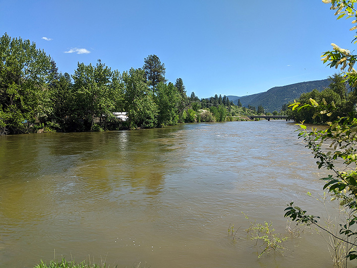
Regarding river levels, the Regional District of Kootenay Boundary said the flood watch for the Boundary region includes the Kettle River, West Kettle River, Granby River and tributaries.
- Thorhild, Westlock counties declare state of agricultural disasters due to rain
- ‘Prolonged stretch of hot air,’ poor air quality advisories blanket the Prairies
- 2 tornadoes touched down in Rocky Mountain House, Environment Canada confirms
- Heavy Nova Scotia rain threatens flooding on anniversary of deadly 2023 flash flood


“This means that river levels are rising and will approach or may exceed bank-full,” the regional district said in the press release.

Get daily National news
“Flooding of areas adjacent to affected rivers may occur.”

It says current river forecasts show the Kettle River at typical freshet levels for the next 48 hours, then rising to moderate flood levels on Sunday, May 31 through Tuesday, June 1, depending upon rainfall location and amounts.
“This freshet has really been unrelenting in the sense that the Kettle River has been close to bank-full for over a month now,” said Mark Stephens, Emergency Operations Centre director. “This means any spike in temperature or precipitation puts low-lying areas immediately at risk of flooding.
“In the past 24 hours the forecasts have dropped slightly as we receive more accurate information, but we are still watching for a scenario that could approach or exceed what we saw in 2017, where low-lying properties were flooded and we saw access to some roads cut off.”
The mayor of Grand Forks, Brian Taylor, said the city was nervous in seeing another flood scenario, but that the city is ready.
“We have never, as a city, or as citizens, been more prepared,” said Taylor, “and the city is fully involved in the EOC every day through our operational and planning staff.”
“We don’t control what the weather throws at us, but we do control how prepared we are and how well we cooperate as a community and a region during an emergency,” added Diane Langman, RDKB chairperson.
“From Big White to Christina Lake, our communities have been working with our EOC to gather important river data and to communicate with local residents since early spring so everyone is aware that they need to prepare for possible flooding in low-lying areas.”
The regional district is also warning people to stay away from water edges and to report any erosion or flooding to the provincial emergency coordination centre at 1-800-663-3456.
Comments
Want to discuss? Please read our Commenting Policy first.