

Update: As of 7:43 p.m., the special weather statement has ended and wind warnings have ended for Chatham-Kent, Elgin, and Essex. A wind warning remains in effect for Haldimand and Norfolk.

A special weather statement has been issued for London and Middlesex County cautioning of strong westerly gusts that could reach 80 km/h.
The gusts are expected to begin this afternoon and continue into the early evening before diminishing later tonight, the advisory said.
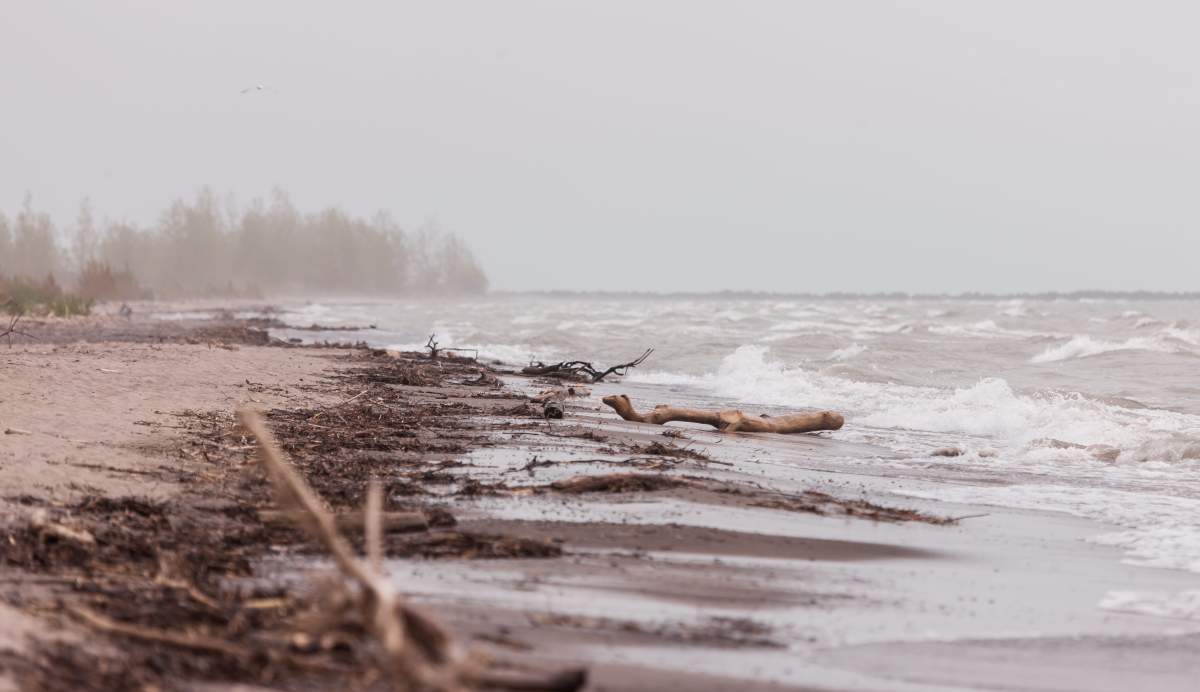
The same system has prompted wind and gale warnings along Lake Erie with local conservation authorities warning of flooding due to storm surge.
READ MORE: 6 dead after strong storms sweep U.S. south
According to Environment Canada, west to southwesterly gusts up to 90 km/h will be possible in Chatham-Kent, Elgin, Essex, Haldimand and Norfolk counties Monday, with the strongest winds expected along the lake.
Scattered power outages are possible, along with damage to buildings, such as to roof shingles and windows, the advisory said.
The national weather agency has issued gale warnings for eastern and western Lake Erie as part of its marine forecast, saying one-and-a-half metre waves are expected today, building to two to three metres this afternoon before subsiding in the evening. A similar gale warning is also in place for southern Lake Huron.
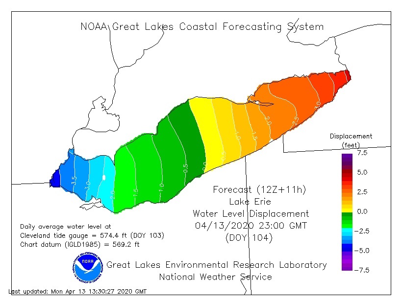
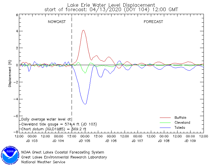
Water levels in Lake Erie have been above the record high water mark since late January, according to Global News chief meteorologist Anthony Farnell.

Get breaking National news
Due to the strong winds and change in air pressure, he says a seiche is expected to take place in Lake Erie. “Picture bathtub water sloshing towards one side then back the other way,” he wrote on Twitter.
As a result, water levels in the lake will be nearly 10 feet, about 3 metres, higher in Buffalo, N.Y. Monday night compared to the other side of the lake in Toledo, Ohio, according to an NOAA forecast.
Flood warnings are in effect along the Lake Erie shoreline from Long Point Region, Grand River and Niagara Peninsula conservation authorities, stretching from Port Burwell east to Port Colborne.
“Norfolk County is urging those who can to leave lakeshore communities ahead of significant flooding expected to begin midday Monday,” the county said in a statement Sunday.
- Old Man Winter wallops B.C.’s Mainland/Southwest region, major highway closed
- Calgary hit by unexpected blast of spring snow, causing dozens of crashes
- False spring strikes again: Saskatchewan prepares for incoming winter weather
- Albertans’ interest in alternative forms of travel growing as fuel prices spike


“Those who can’t leave these areas are advised to shelter in place if flooding begins and to avoid walking or driving through flooded streets.”
The Ministry of Natural Resources and Forestry was forecasting water levels in Lake Erie to rise nearly half a metre around western Long Point and rise nearly a metre around Port Colborne, according to the Long Point Region Conservation Authority (LPRCA).
“Peak levels are currently expected to occur between late Monday afternoon through Monday evening,” LPRCA said Sunday. “Wave heights are forecast to reach up to two metres along the shoreline.”

READ MORE: Waterloo police issue warning after resident duped out of $500 in coronavirus-related puppy scam
Flood watches are also in place from the Kettle Creek, Lower Thames Valley and Essex Region conservation authorities, stretching along the Lake Erie shoreline from Port Stanley west to the Amherstburg area.
According to the Lower Thames Valley Conservation Authority (LTVCA), wave height forecasts suggested waves of three to four metres high in the open waters of the lake, with waves as high as a metre-and-a-half possible in near-shore areas.
“Due to high lake levels,” LTVCA said Sunday, “there is a risk that wave action could damage shoreline protection works and cause erosion all along the Lake Erie shoreline in Chatham-Kent and Elgin County, including along the high bluff areas.”
Conservation authority officials added that significant flooding along Erie Shore Drive, south of Blenheim, Ont., and an increased risk of shoreline damage elsewhere was expected if winds reached their forecast strengths.
If winds shift to the west-northwest, the flood watch says, there is a risk that wave action could damage shoreline protection works and cause erosion along the Lake St. Clair shoreline, around Lighthouse Cove and in Chatham-Kent on the eastern side of the lake.
Comments
Want to discuss? Please read our Commenting Policy first.