


The flood watch for Metro Vancouver was lifted Sunday, after residents spent Saturday nervously watching high river levels due to days of heavy rains.

But across the rest of the Lower Mainland and Vancouver Island, states of emergency due to landslides, road washouts and flood warnings have forced evacuations and stalled some traffic.
A state of emergency remains in the District of Kent, after a washout affected Rockwell Drive in Harrison Hot Springs and damaged water infrastructure for nearby lakefront properties.
An evacuation order has been issued for up to 40 properties in the area, which have also lost drinking water due to a landslide that damaged a water main.
Rockwell Drive is closed in both directions between Dogwood Lane and Rockwell Lane. The Ministry of Transportation is currently assessing the road to determine how long it will take to clear.
Elsewhere in the Fraser Valley, Highway 11 in Abbotsford remains closed due to flooding between Third and Fourth avenues just north of the U.S. border crossing at Sumas.
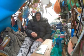
Near Agassiz, the only road to Sasquatch Mountain Resort remains washed out, with the Ministry of Transportation predicting it could be four to five days until a single lane is restored.

Power was finally restored to the resort Sunday afternoon, and helicopters have been transporting people down the mountain throughout the day.
Landslides have also closed Highway 12 between Six Mile Road and Kirbys Flat Road north of Lytton, and the Lillooet-Pioneer Road known as Road 40 between Mission Mountain Road and Yalakom Road. Other slides, including one on Highway 1 near Boston Bar, have been fully or partially cleared.
At least one of those landslides is potentially to blame for a widespread outage for cell and phone service across B.C., which has affected police non-emergency lines and internet access.
Service has largely recovered since the issue was first reported Saturday, but some customers are still experiencing problems across multiple carriers.
- Three B.C. men fined, banned from hunting after killing pregnant deer
- B.C. child-killer’s attempt to keep new identity secret draws widespread outrage
- Inquest hears B.C. hostage was lying on her captor before fatal shooting
- ‘We’ve had to make a 180’: What Oregonians say they got wrong with decriminalization
On the Sunshine Coast, a washout on Squamish Valley Road roughly five kilometres from Highway 99 is blocking all vehicles except for local traffic only.
BC Hydro says more than 100 people were still without power in Squamish as of noon due to a mudslide.
The Ministry of Transportation is advising people to check DriveBC for the latest updates as crews work to clear and repair affected roads.
Vancouver Island issues remain
On Vancouver Island, the River Forecast Centre has kept a flood warning in place for western, eastern and southern portions of the island, while central areas like Port Alberni are under a less serious flood watch.
Of particular concern are the Cowichan River near Duncan, the Chemainus River near Westholme, and the Nanaimo River near Cassidy. However, officials say stream flows are beginning to recede.


A state of emergency remains for the Cowichan Valley Regional District, despite officials saying the threat of further flooding has subsided.
Roughly 30 residents evacuated from parts of North Cowichan and the Halalt First Nation have since found other places to stay after spending time in the Cowichan Community Centre, which was used as an emergency reception centre Saturday.
Transit service was restored Sunday on Chemainus Road and to the Halalt community.
The evacuation order was later lifted on Sunday afternoon, allowing people to return to their homes after “the immediate threat” passed, the district said. However, the state of emergency remains in effect.

With flood waters receding, attention is now turning to the damage left behind.
In Chemainus, homeowner Scott Bruce was left with flood damage inside his home as well as a washed-out driveway, along with large logs across his waterfront yard that were dropped there by the high waters.
“I was praying to all the gods — Odin, Thor, Jesus — and they kept it from going past that level,” he said.
Several of Bruce’s neighbours also saw their homes flooded, as well as vehicles and RVs on their properties.
In ending its flood watch for Metro Vancouver and Howe Sound, the River Forecast Centre said river and stream flows have receded back to normal levels. No further rises are expected.
Comments