
Cloud cover kicked off the final week of January with pockets of showers swinging through the valley bottom early Monday as temperatures dipped toward the freezing mark to start the day.

Sunny breaks became apparent by mid-morning as the valley bottom warms into mid-positive single digits for an afternoon high.
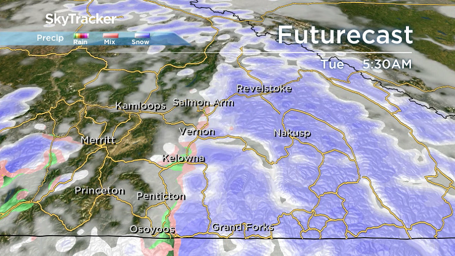
Another pulse of precipitation passes through Monday night into early Tuesday with 2 to 4 centimetres of snow expected by morning as precipitation switches to showers before easing off.

During the afternoon skies will start to clear and sunshine filters back in as the region warms back into mid-single digits.
Clouds build back in by Wednesday morning with a risk of rain and snow during the day before skies clear out in the evening, causing temperatures to fall from around 4 degrees back to -4.


A brief break from the moisture is expected on Thursday with a sunny morning followed by clouds rolling back in during the day.
The next round of precipitation arrives Friday and lingers into the weekend as daytime highs surge into the 6 to 8 degree range.

For weather on the go download the Global News SkyTracker Weather App for iPhone, iPad or Android.
- Canadian man dies during Texas Ironman event. His widow wants answers as to why
- ‘Shock and disbelief’ after Manitoba school trustee’s Indigenous comments
- Several baby products have been recalled by Health Canada. Here’s the list
- ‘Sciatica was gone’: hospital performs robot-assisted spinal surgery in Canadian first
Comments