

UPDATE: All warnings mentioned in this story have ended

A cold arctic air mass causing extreme cold warnings in northern Saskatchewan is expected to remain in place for the rest of the week.
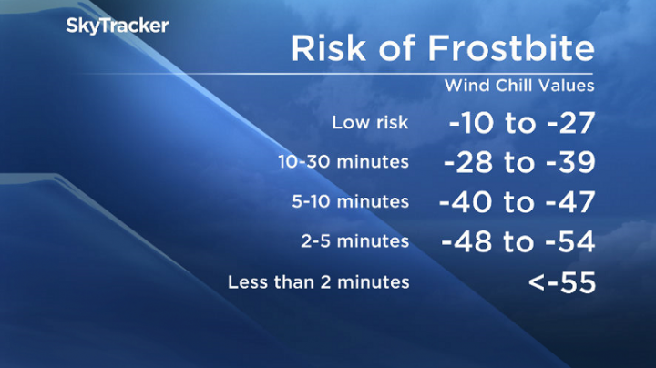
Environment Canada said Wednesday wind chills will moderate during the day in northern parts of the province before falling into the -45 to -50 range overnight for several more days.
Wind chill warnings that were in place for some central and eastern regions have been lifted.
It is the first major cold wave of the winter and will persist well into the week, officials say.
Frostbite can occur in less than 10 minutes at these values.


Anyone heading outside should dress warmly and in layers and ensure the outer layer is wind resistant.

Get breaking National news
People working outside should take regular breaks to warm up.
Cold-related symptoms include shortness of breath, chest pain, muscle pain and weakness, numbness and colour changes in fingers and toes.
Emergency supplies, such as extra blankets and jumper cables, should be kept in vehicles.
Environment Canada issues extreme cold warnings when there is an elevated risk to health such as frostbite or hypothermia.
Download the SkyTracker weather app for the latest conditions and warnings.
Comments
Want to discuss? Please read our Commenting Policy first.