
Spotty showers started the second week of October in the Central Okanagan as temperatures dipped to 8 degrees to start the day.

A breezy southwesterly wind kicks in during the afternoon as scattered sprinkles continue and the mercury makes it into the low teens to finish the day.
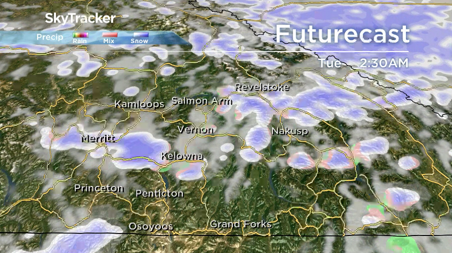
A potent cold front pushing in Monday night brings back the risk of rain with up to 10 centimetres of snow possible along the Okanagan Connector, where a special weather statement has been issued.

Get breaking National news
Isolated showers will kick off the day Tuesday morning in the valley bottom with snow levels around 900 metres and icy roads possible at higher elevations as the pockets of precipitation linger into the afternoon.

After reaching an afternoon high in upper single digits, the clouds and showers slide out Tuesday night as temperatures dive below freezing by as much as 3 degrees.


Despite a chilly start to the day on Wednesday and a daytime high of only 7 degrees, sunshine will kick into full swing and last right through the rest of the week.
Afternoon highs will be on the rise, surging back into low double digits both Thursday and Friday.
Thanksgiving long weekend will bring a return to clouds on Saturday and a chance of showers Sunday as daytime highs linger in low double digits right through holiday Monday.

For weather on the go download the Global News SkyTracker Weather App for iPhone, iPad or Android.


Comments