
After a weekend that brought cooler temperatures to the Okanagan and snow to high elevation mountain highways, a reprieve is on the way to start October.

Light showers and mountain flurries stuck around to start the final day of September as temperatures slipped to 3 degrees above freezing in Kelowna.
The valley bottom will warm into low double digits during the day as clouds linger before clearing out into the evening.
Clear conditions under an arctic ridge of high pressure brings in a risk of frost overnight as temperatures dive below freezing by a degree or 2, so be sure to cover up or bring in any frost sensitive plants.

Sunshine will start the day on Tuesday before clouds associated with the next frontal boundary push in during the evening after the mercury makes it back into the mid-teens.


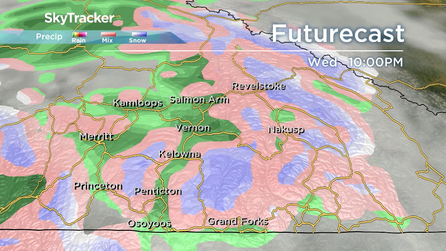
Clouds stick around on Wednesday with a chance of showers into the evening hours that could change over to snow at elevations of 1300 metres or higher

After a damp start to the day on Thursday with some lingering showers, sunny breaks begin to work their way back in during the afternoon as temperatures return to the mid-teens.
A mix of sun and cloud and mid-teen daytime highs will stick around Friday, into the weekend and beyond.

For weather on the go download the Global News SkyTracker Weather App for iPhone, iPad or Android.
- ‘Shock and disbelief’ after Manitoba school trustee’s Indigenous comments
- ‘Super lice’ are becoming more resistant to chemical shampoos. What to use instead
- Is home ownership only for the rich now? 80% say yes in new poll
- Invasive strep: ‘Don’t wait’ to seek care, N.S. woman warns on long road to recovery
Comments