
Weather forecasters say Hurricane Humberto will lash Bermuda with high winds and heavy rain later this week.

The U.S. National Hurricane Center in Miami said Monday that Humberto could become a major hurricane by Tuesday night, bringing with it the likelihood of tropical-storm-force winds to Bermuda on Wednesday, with heavy rain beginning Thursday.
READ MORE: Over 2,500 registered as missing as death toll of hurricane Dorian rises to 50 in Bahamas
Swells generated by Humberto will roil the northwestern Bahamas coast as well as the southeastern U.S. Atlantic coast from central Florida to North Carolina over the next few days. Such swells could pose life-threatening surf and rip current conditions to swimmers and surfers.
The hurricane centre said at 11 a.m. EDT that the centre of the storm is about 710 miles (1,145 kilometres) west of Bermuda and is moving east-northeast at 7 mph (11 kph), with maximum sustain winds of 85 mph (140 kph).
Beachgoers on the southeastern U.S. coast should be wary of potentially dangerous rip currents caused by Hurricane Humberto, the National Hurricane Center said Sunday.
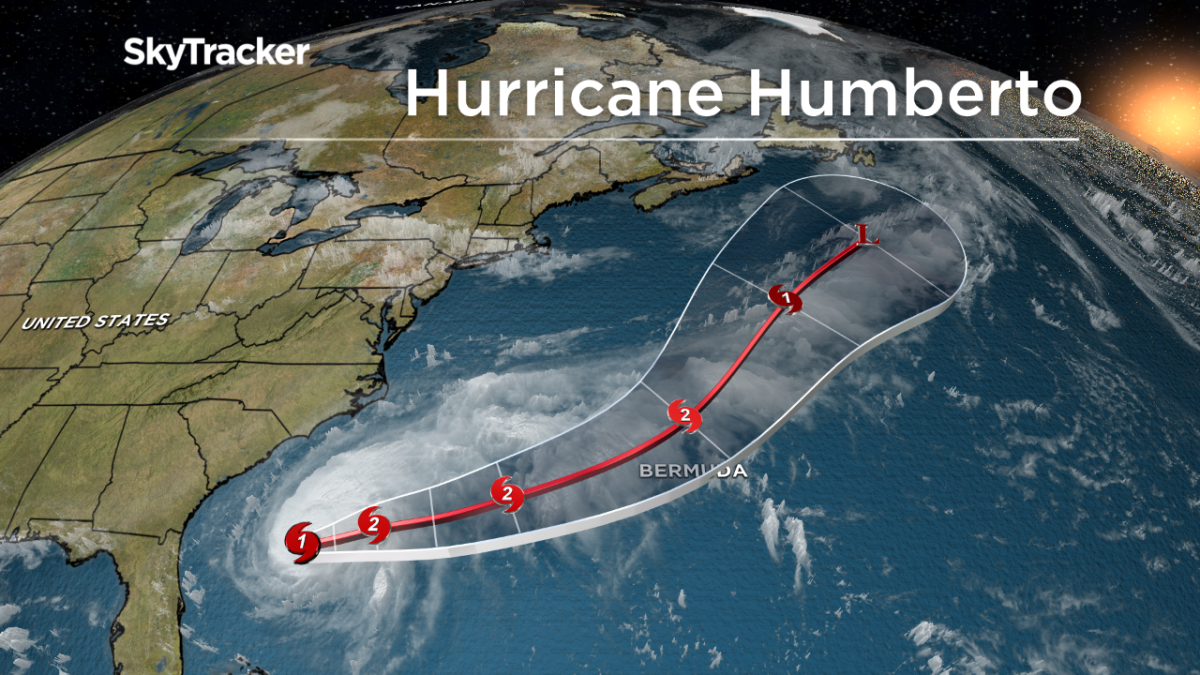
Late Sunday, Humberto strengthened to a Category 1 hurricane. By early Monday, the storm had maximum sustained winds of 85 mph (137 kph). The storm was about 760 miles (1,223 kilometres) west of Bermuda and moving northeast at 5 mph (8 kph).


Get daily National news
The U.S. National Hurricane Center said Humberto will bring large swells to the northwestern Bahamas and southeastern U.S. coast for several days.
WATCH: Tropical storm Humberto lashes Bahamas as nation recovers from Dorian

The National Weather Service issued advisories warning of high rip current risks through Monday evening at beaches from northeast Florida to North Carolina.
Rip currents are narrow channels of water that move away from shore at high speed, posing a drowning threat to swimmers.
Additional strengthening is forecast through Wednesday, when the eye of the storm is expected to be out in the open Atlantic.
Comments
Want to discuss? Please read our Commenting Policy first.