
Temperatures took quite a tumble behind a cold front over the weekend with daytime highs falling from 29 degrees on Saturday to 18 on Sunday with rain and storms as it came through.

The second week of school kicked off on a damp and cloudy note with showers in parts of the valley and temperatures in the low teens.
Showers continue with the risk of thunderstorms Monday afternoon and evening as the mercury climbs into the high teens once again for a daytime high.
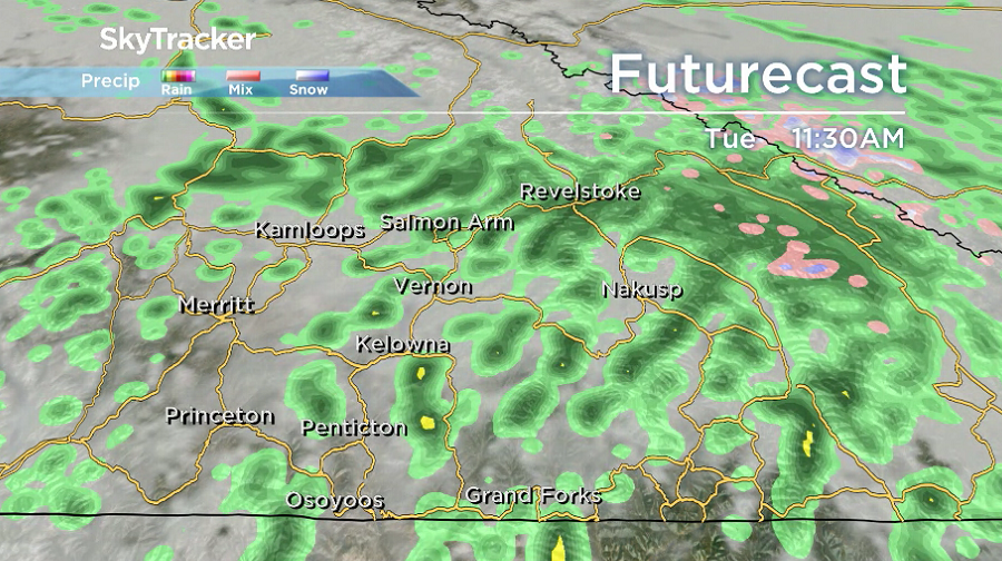
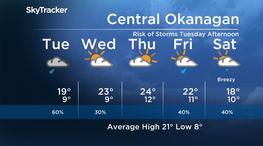
The upper-level trough generating the precipitation lingers on Tuesday with a good chance of showers through the entire day with the risk of an afternoon thunderstorm.
After hitting a daytime high in the high teens yet again on Tuesday, the risk of rain will begin to diminish heading into Wednesday as clouds clear late in the day and temperatures return to the low 20s.


The break from the clouds won’t last long, as after some sunny breaks early Thursday, clouds roll back in along the next front with an afternoon high making it into the mid 20s.
The second week of school will finish how it started, cloudy and damp, with a chance of showers and an afternoon high in the low 20s on Friday.
Another cold front is on the way this weekend, which will dunk daytime highs back into the high teens with cloud and chance of showers both Saturday and Sunday.
For weather on the go download the Global News SkyTracker Weather App for iPhone, iPad or Android.
- ‘Shock and disbelief’ after Manitoba school trustee’s Indigenous comments
- ‘Super lice’ are becoming more resistant to chemical shampoos. What to use instead
- Is home ownership only for the rich now? 80% say yes in new poll
- Invasive strep: ‘Don’t wait’ to seek care, N.S. woman warns on long road to recovery
Comments