
As Hurricane Dorian continues to cause devastation in the Bahamas on Tuesday, forecasters warn that three other storms are also forming.

A tweet posted by the National Oceanic Atmospheric Administration (NOAA) on Tuesday said hurricane season is “heating up,” and pointed to a tropical storm, a category three hurricane and a tropical depression that have been detected.
Here’s a look at what is happening:
Hurricane Dorian
Dorian pounded the islands of Abaco and Grand Bahama with winds up to 295 km/h and torrential rain before finally moving into open waters on a course for Florida. Its winds were down to a still-dangerous 175 km/h.
And, according to Global News Chief Meteorologist Anthony Farnell, after nearly two days of sitting over northern Bahamas, Dorian is on the move.
“The hurricane tapped all the energy available from the ocean while stationary and weakened down to a category 2 hurricane,” he said.
WATCH: Georgia officials warn ‘unique’ Hurricane Dorian could gain in strength

“Now that it’s moving over very warm Gulf Stream water, some minor intensification is possible before interacting with the south and north Carolina coastline,” he continued.
Farnell says the wind field will continue to expand, meaning more of the coastal southeast U.S. will experience tropical storm or hurricane force gusts and storm surges of up to seven feet.
Over two million people along the coast in Florida, Georgia and North and South Carolina were warned to evacuate.

Get breaking National news
In the Bahamas, Red Cross spokesman Matthew Cochrane said more than 13,000 houses, or about 45 per cent of the homes Grand Bahama and the Abaco Islands, were believed to have been severely damaged or destroyed. U.N. officials said more than 60,000 people on the hard-hit islands will need food, and the Red Cross said some 62,000 will need clean drinking water.
WATCH: North Carolina governor announces mandatory evacuation for Barrier Islands: ‘Do not try to ride it out’

While the threat of a direct hit on Florida had all but evaporated, Dorian was expected to pass dangerously close to Georgia and South Carolina — and perhaps strike North Carolina — on Thursday or Friday.
“After North Carolina, Dorian will accelerate towards Atlantic Canada, potentially bringing gusty winds and torrential rain this weekend,” Farnell said.
Tropical storm Fernand
According to the NOAA, a tropical storm named Fernand has also been spotted in the Atlantic.
Tropical Storm Fernand is slowly strengthening in the Gulf of Mexico, the NOAA says, with maximum sustained winds of nearly 64 km/h. It’s forecast to reach the northeastern coast of Mexico by late Tuesday or early Wednesday.
The storm is located 257 kilometres east of La Pesca, moving towards the west at a speed of 11 km/h.
According to the National Hurricane Centre (NHC), just before 5 p.m. on Tuesday, the storm was approaching the northeastern Mexico coast.
-
![]() Upcoming FIFA World Cup prompts questions about plan for Vancouver’s homeless
Upcoming FIFA World Cup prompts questions about plan for Vancouver’s homeless -
![]() Trump pushes for peace with Iran at the same time he deploys thousands of troops to region
Trump pushes for peace with Iran at the same time he deploys thousands of troops to region -
![]() Russian drone attacks injure 9 people in Ukraine’s Kharkiv
Russian drone attacks injure 9 people in Ukraine’s Kharkiv -
![]() First female Archbishop of Canterbury delivers message before being enthroned
First female Archbishop of Canterbury delivers message before being enthroned


In a tweet posted Tuesday, the centre said a tropical storm warning had been issued from Barra del Tordo southward to Puerto Altamira.
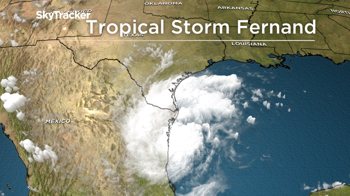
However, Global News Chief Meteorologist Anthony Farnell says the storm will “quickly weaken” after landfall in northern Mexico on Wednesday.
Fernand is the sixth named tropical storm of the 2019 Atlantic hurricane season.
Hurricane Juliette
Meanwhile, in the eastern Pacific, category 3 Hurricane Juliette is recording wind speeds near 200 km/h.
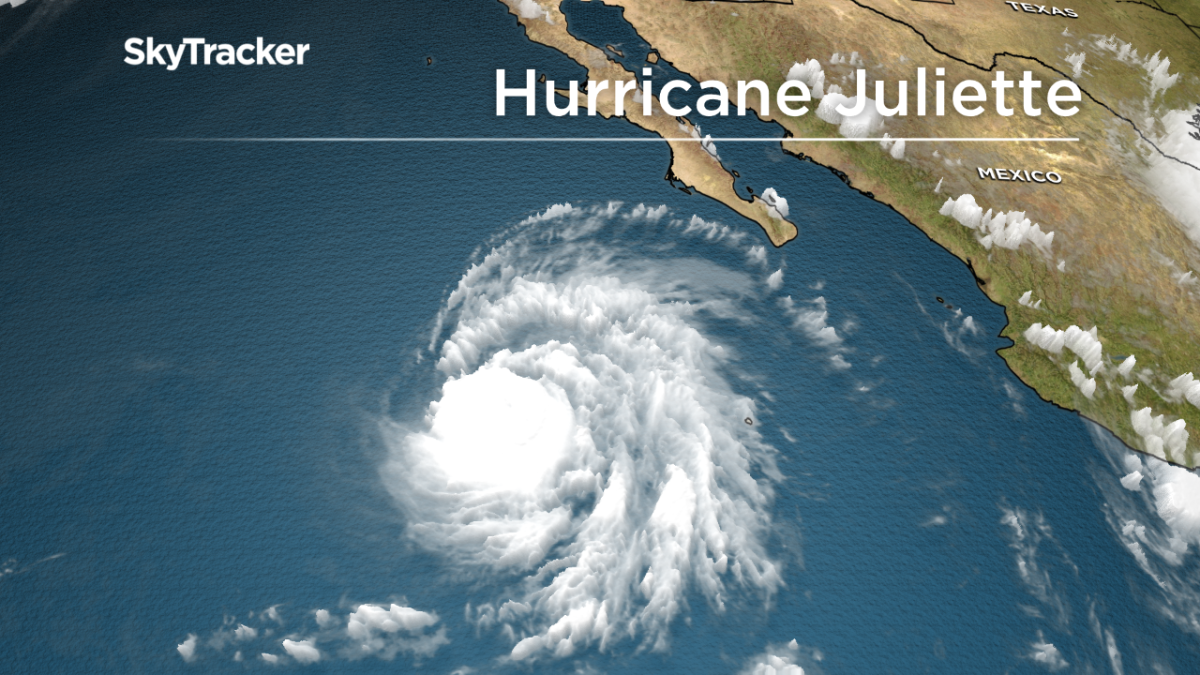
“Hurricane Juliette is in the eastern Pacific, well off Mexico’s Pacific coast and headed out to sea,” Farnell said. “The storm rapidly intensified, becoming a major category 3 Hurricane, but wind shear and cooler water will weaken the storm in the coming days.”
WATCH: Canadians stranded in Bahamas after Dorian strikes

Farnell says Hurricane Juliet, however, is not a threat to land.
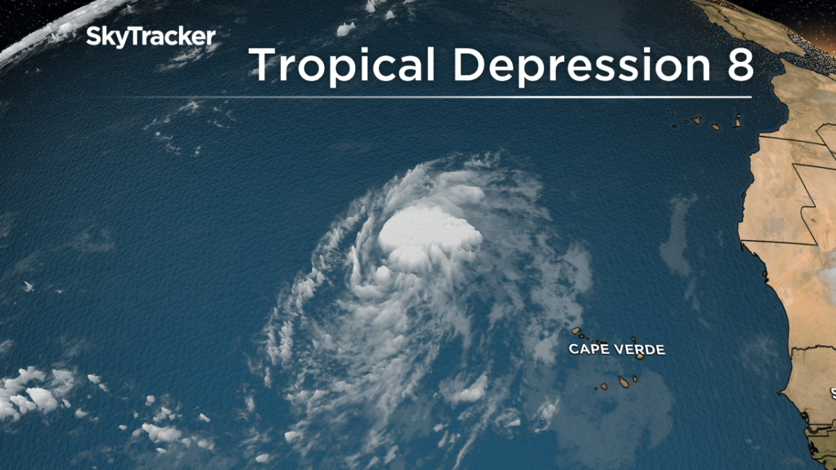
Tropical Depression 8
According to the NHC, a tropical depression has developed over the eastern Atlantic.
“A new, tropical depression just formed closer to the Cape Verde Islands, and is expected to become a tropical storm,” Farnell explained.
However, he says, it will likely stay out in the middle of the Atlantic, without affecting land.
— With files from the Associated Press
Comments
Want to discuss? Please read our Commenting Policy first.