Hurricane Dorian‘s devastating weekend over the Bahamas appears to have left the island of Grand Bahama much smaller than when the storm arrived, based on satellite footage showing the extent of the flooding.

A satellite photo captured in the middle of the storm shows roughly half of Grand Bahama island covered in water on Monday.
The photo from ICEYE, a Finland-based satellite startup, includes yellow lines showing where the shoreline used to be before Dorian hit.
The firm estimates that 60 per cent of the island was underwater at noon on Monday — nearly a full day before the storm churned away.
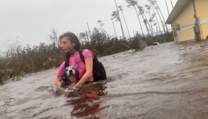
Dorian blew into the Bahamas as a Category 5 hurricane on Sunday and spent Monday and part of Tuesday stalled over the chain of islands. The hurricane’s fearsome power tore off roofs and sent cars tumbling, while Dorian’s heavy rain flooded the entire first floor of many homes.
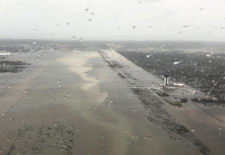
The airport in Grand Bahama was under two metres of water on Tuesday.
Red Cross spokesperson Matthew Cochrane said more than 13,000 houses appear to have been destroyed in Grand Bahama and Abaco. That amounts to about 45 per cent of the homes on the two islands.

Get breaking National news
“What we are hearing lends credence to the fact that this has been a catastrophic storm and a catastrophic impact,” Cochrane said.
At least five deaths have been blamed on the storm.
“We are in the midst of a historic tragedy,” Prime Minister Hubert Minnis said in announcing the fatalities. He called the devastation “unprecedented and extensive.”
Dorian dropped as much as 89 centimetres of rain on the Bahamas, meteorologist Ryan Maue told the Associated Press.
The water was high enough to submerge palm trees in some areas of the popular island getaway.
The storm finally moved off the Bahamas and headed toward Florida on Tuesday as a Category 2 hurricane.
—With files from the Associated Press


Comments
Want to discuss? Please read our Commenting Policy first.