
After starting out the week with some snow at Big White on Labour Day Monday, and frost to kickoff classes Tuesday and Wednesday in some areas, warmer days rolled in to finish the first week of school.

A bit of smoke filtered into the Central Okanagan mid-week, mainly from fires burning in the Similkameen and parts of the northwest U.S.
Environment Canada continued a special air quality statement for the area for smoke potentially reducing air quality at times across the region.
Temperatures were climbing into the upper 20s on Thursday under mostly sunny skies, ahead of a cold front and upper trough that will stir up the weather pattern heading into the weekend.
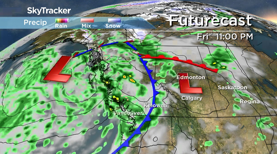
As a result, clouds will roll back in after a sunny start on Friday, with a good chance of rain and the risk of a thunderstorm to end the day as the cold front swings through.
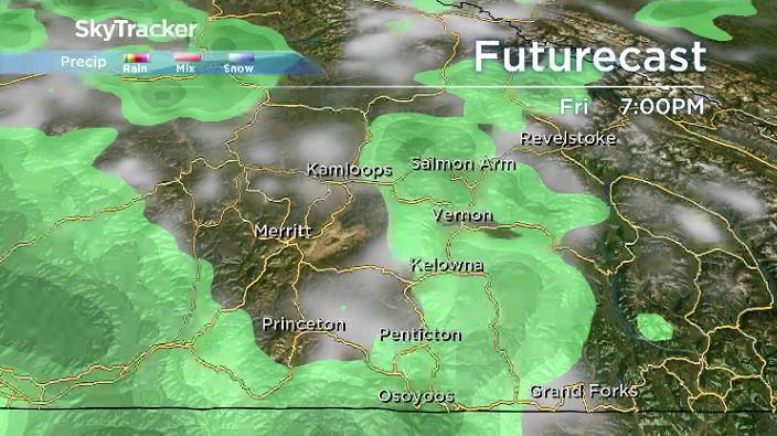
The full effects of the front won’t be felt until the weekend, with daytime highs toppling down from 26 degrees to end the first week of school on Friday to the low 20s on Saturday and Sunday.
Rain will linger at times across the region Friday night before partly-to-mostly cloudy skies slide in for Saturday with breezy conditions continuing.
Another surge of cloud swings in on Sunday, as a system slides ashore that’ll bring in a risk of rain during the day.

The second week of school is shaping up to be cool, with afternoon highs struggling to get into the low 20s and morning lows dipping back into mid-single digits.
Partly to mostly cloudy skies will dominate the week with a chance of rain here and there.


Warm & Wet Summer 2018
Meteorological summer (June, July and August) has wrapped up and the numbers are in.
Despite the smoke that hung around for a record length of time in the Okanagan, temperatures still managed to trend almost 2 degrees warmer than normal throughout the 3-month period.

The majority of this was made up on the overnight low side of the scale, which sat over 2 and a half degrees warmer than normal, which is quite significant when averaging out over 90 days of data.
Daytime highs were 0.73 degrees warmer than normal with only 52.2 millimetres of rain falling, which is only 45% of the average amount of 115.2 millimetres.
For weather on the go download the Global News SkyTracker Weather App for iPhone, iPad or Android.
Comments