

Many areas were doused by rain overnight, and there’s more rain in the forecast this week for southern Manitoba.

Sunday night, southern Manitoba saw showers and thunderstorm activity.
The highest rainfall amounts were around 30mm which were recorded in Sundown and Neepawa by CocoRahs stations.
The highest total recorded in Winnipeg on this site was 14mm which doesn’t sound like a lot but it’s the second highest rainfall total of the summer.
Obviously, it’s been a dry summer. According to Environment and Climate Change Canada, most of southern Manitoba has had between 40-60 per cent of normal rain amounts.
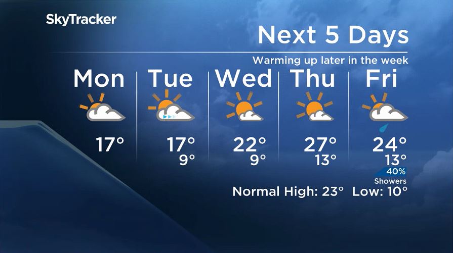
Monday will bring more rain to Winnipeg and southern Manitoba. While some showers will move in Monday afternoon from south of the border, most of the rain Winnipeg will see will come late Monday night. Not that it is expected to be a lot of rain, but more than in the afternoon.

Get breaking National news
The rain will be wrapped up by Tuesday morning but even with skies clearing, temperatures Tuesday will stay on the cooler side.
Later in the week, temperatures should start to warm up back above seasonal as high pressure will build south of the border.
Thursday is likely to be the warmest day of the week with temperatures getting into the mid to high 20s.


WATCH: Weakened Hurricane Lane dumps heavy rain on Hawaii

Comments
Want to discuss? Please read our Commenting Policy first.